File:Chaul End Road (C) Richard Thomas - Geograph - 263236.jpg

From Roader's Digest: The SABRE Wiki
Jump to navigation Jump to search

Chaul_End_Road_(C)_Richard_Thomas_-_Geograph_-_263236.jpg(640 × 444 pixels, file size: 148 KB, MIME type: image/jpeg)

Y topleft.gifY topright.gif
Description:
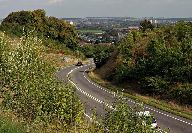
Chaul End Road (C) Richard Thomas
The winding hill that forms part of Chaul End Road, linking Chaul End and Caddington to parts of Luton that are West of the M1. This road can just be seen in the mid distance.
Location:51.884826, -0.471476
Road:
Date:27 09 2006
Photographer:Richard Thomas and licensed for reuse under this Creative Commons Licence
Source:Geograph

Map

Y btmleft.gifY btmright.gif

Galleries  | Escape lane | Bedfordshire

File history

Click on a date/time to view the file as it appeared at that time.

Date/TimeThumbnailDimensionsUserComment
current17:54, 31 August 2014Thumbnail for version as of 17:54, 31 August 2014640 × 444 (148 KB)Glen (talk | contribs)'''Chaul End Road (C) Richard Thomas '''<br/>The winding hill that forms part of Chaul End Road, linking Chaul End and Caddington to parts of Luton that are West of the M1. This road can just be seen in the mid distance.

Metadata

SABRE - The Society for All British and Irish Road Enthusiasts
Discuss - Digest - Discover - Help