File:Church of St Stephen, Redditch - Geograph - 7219.jpg
Jump to navigation
Jump to search

No higher resolution available.
Church_of_St_Stephen,_Redditch_-_Geograph_-_7219.jpg (640 × 480 pixels, file size: 79 KB, MIME type: image/jpeg)
| |||||||||||||||||||||||||
|
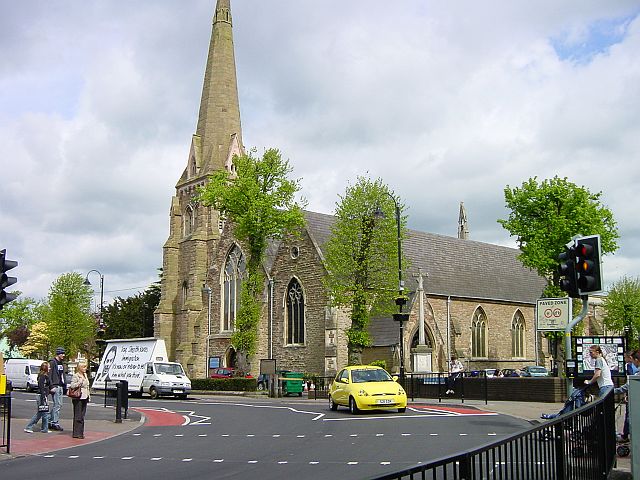
Galleries | A441 | A4023 | Redditch | Pelican Crossing | ||
File history
Click on a date/time to view the file as it appeared at that time.
| Date/Time | Thumbnail | Dimensions | User | Comment | |
|---|---|---|---|---|---|
| current | 15:48, 4 November 2009 | | 640 × 480 (79 KB) | Jeni (talk | contribs) | {{Information |description = In years gone by, this was where the first incarnation of the A4023 met the A441 in the town centre. Now however, it is just a local road in the town centre, with parts of the A441 buried under a shopping centre. |day |
File usage
The following 3 pages use this file: