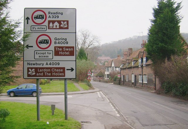
Confusing Roadsign, Streatley A picture of a roadsign at Streatley, which at first seems quite normal. But it is a very confusing roadsign due to being placed too far back from the junction it is referring to! The road to the left of this picture is just a cul de sac that leads to the Lardon Cottages, and NOT the B4009 into Goring, which according to a local resident of Streatley, causes endless wrong turnings by unfamiliar motorists! When viewed from this direction, this is easily understood. With another roadsign placed at the crossroads up ahead (just visible in background), this sign is unnecessary.
'''Confusing Roadsign, Streatley'''<br/>A picture of a roadsign at Streatley, which at first seems quite normal. But it is a very confusing roadsign due to being placed too far back from the junction it is referring to! The road to the left of this pictur
File usage
There are no pages that use this file.
Metadata
This file contains additional information, probably added from the digital camera or scanner used to create or digitise it.
If the file has been modified from its original state, some details may not fully reflect the modified file.
