File:Dolgellau Bridge (C) Jonathan Billinger - Geograph - 1523198.jpg

From Roader's Digest: The SABRE Wiki
Jump to navigation Jump to search

Dolgellau_Bridge_(C)_Jonathan_Billinger_-_Geograph_-_1523198.jpg(640 × 480 pixels, file size: 218 KB, MIME type: image/jpeg)

Y topleft.gifY topright.gif
Description:
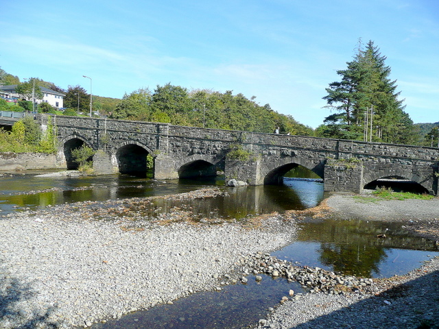
Dolgellau Bridge (C) Jonathan Billinger
The gridline cuts across this structure at its mid-point. This view from the south bank of the Wnion shows the low level of the river after a prolonged dry spell in the early autumn of 2009.
Location:52.744533, -3.885015
Road:
Date:05 10 2009
Photographer:Jonathan Billinger and licensed for reuse under this Creative Commons Licence
Source:Geograph

Map

Y btmleft.gifY btmright.gif

Galleries  | Dolgellau

File history

Click on a date/time to view the file as it appeared at that time.

Date/TimeThumbnailDimensionsUserComment
current16:08, 4 April 2014Thumbnail for version as of 16:08, 4 April 2014640 × 480 (218 KB)Ritchie333 (talk | contribs)'''Dolgellau Bridge (C) Jonathan Billinger '''<br/>The gridline cuts across this structure at its mid-point. This view from the south bank of the Wnion shows the low level of the river after a prolonged dry spell in the early autumn of 2009.

The following 2 pages use this file:

Metadata

SABRE - The Society for All British and Irish Road Enthusiasts
Discuss - Digest - Discover - Help