File:Escape Lane (C) wfmillar - Geograph - 1261005.jpg
Jump to navigation
Jump to search

No higher resolution available.
Escape_Lane_(C)_wfmillar_-_Geograph_-_1261005.jpg (640 × 480 pixels, file size: 122 KB, MIME type: image/jpeg)
| |||||||||||||||||||||||||
|
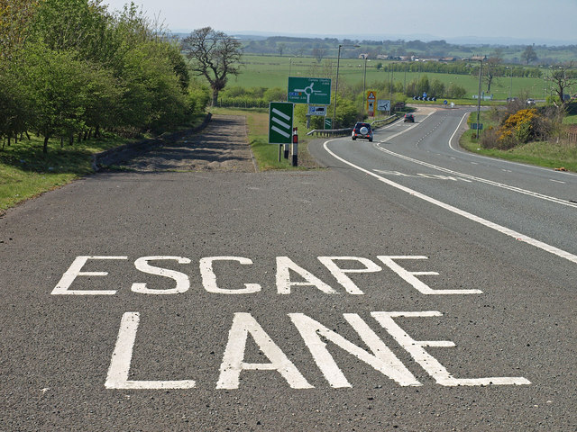
Galleries | A69 | Brampton Bypass Junction | Escape lane | ||
File history
Click on a date/time to view the file as it appeared at that time.
| Date/Time | Thumbnail | Dimensions | User | Comment | |
|---|---|---|---|---|---|
| current | 13:43, 31 August 2014 | | 640 × 480 (122 KB) | Glen (talk | contribs) | '''Escape Lane (C) wfmillar '''<br/>On the A69(T) descending Caponhill before the roundabout near Brampton. The trough at the end of the lane is filled with rough sand to stop vehicles with brake failure. You may see that a few tracks are evident in th... |
File usage
The following 4 pages use this file:
_wfmillar_-_Geograph_-_1261005.jpg&oldid=384813)