File:Gosport Ferry Sailing for Portsmouth - Geograph - 1427874.jpg

From Roader's Digest: The SABRE Wiki
Jump to navigation Jump to search

Gosport_Ferry_Sailing_for_Portsmouth_-_Geograph_-_1427874.jpg(640 × 427 pixels, file size: 44 KB, MIME type: image/jpeg)

Y topleft.gifY topright.gif
Description:
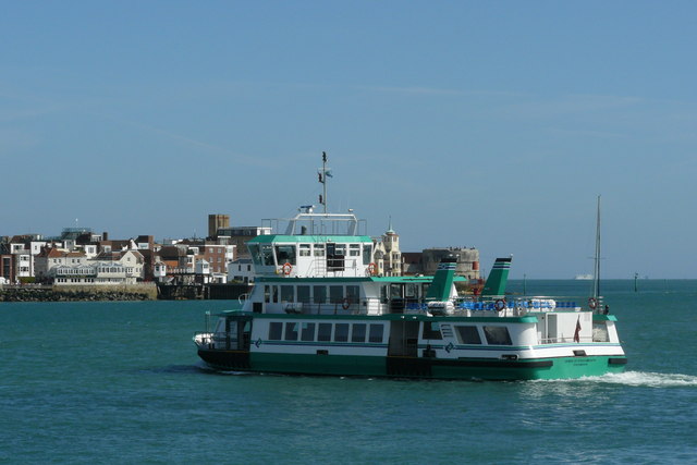
Gosport Ferry Sailing for Portsmouth
The 'Spirit of Portsmouth' appears to be empty, as it leaves Gosport at 3.20pm. In the distance is The Point, with the Still & West to the left of picture, and the Round Tower towards the right.
Location:50.794137, -1.114889
Road:A32
Date:03 08 2009
Photographer:� Copyright Peter Trimming and licensed for reuse under this Creative Commons Licence
Source:Geograph

Map

Y btmleft.gifY btmright.gif

Galleries  | A32 | Gosport Ferry

File history

Click on a date/time to view the file as it appeared at that time.

Date/TimeThumbnailDimensionsUserComment
current20:33, 15 May 2010Thumbnail for version as of 20:33, 15 May 2010640 × 427 (44 KB)Bob@romiley1 (talk | contribs)'''Gosport Ferry Sailing for Portsmouth'''<br/>The "Spirit of Portsmouth" appears to be empty, as it leaves Gosport at 3.20pm. In the distance is The Point, with the Still & West to the left of picture, and the Round Tower towards the right.

The following 2 pages use this file:

Metadata

SABRE - The Society for All British and Irish Road Enthusiasts
Discuss - Digest - Discover - Help