File:Hanger Lane station during major work on A40 road, 1979 - Geograph - 3598362.jpg

From Roader's Digest: The SABRE Wiki
Jump to navigation Jump to search

Hanger_Lane_station_during_major_work_on_A40_road,_1979_-_Geograph_-_3598362.jpg(640 × 397 pixels, file size: 93 KB, MIME type: image/jpeg)

Y topleft.gifY topright.gif
Description:
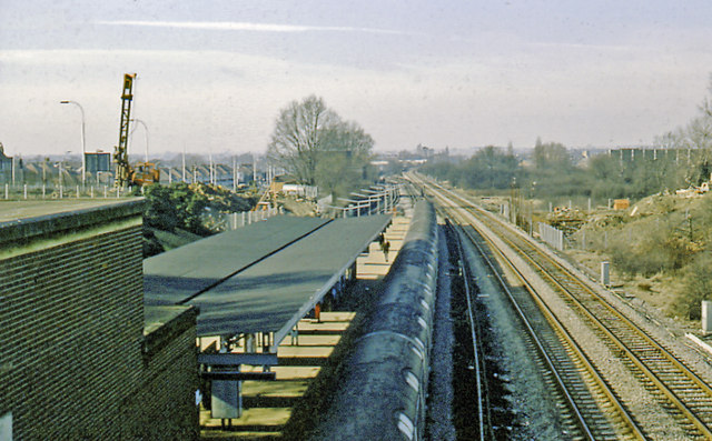
Hanger Lane station during major work on A40 road, 1979 View westward, towards Greenford, Northolt Junction, High Wycombe and Birmingham etc. on the ex-GWR main line (North Acton - Greenford - Northolt Junction section) on the right, with the LT Central Line to West Ruislip at the island platform on the left.
Location:51.530166, -0.293944
Road:A40
Date:25 02 1979
Photographer:(c) Copyright Ben Brooksbank and licensed for reuse under this Creative Commons Licence
Source:Geograph

Map

Y btmleft.gifY btmright.gif

Galleries  | A40 | Hanger Lane Gyratory

File history

Click on a date/time to view the file as it appeared at that time.

Date/TimeThumbnailDimensionsUserComment
current06:57, 24 May 2016Thumbnail for version as of 06:57, 24 May 2016640 × 397 (93 KB)C2r (talk | contribs)'''Hanger Lane station during major work on A40 road, 1979''' View westward, towards Greenford, Northolt Junction, High Wycombe and Birmingham etc. on the ex-GWR main line (North Acton - Greenford - Northolt Junction section) on the right, with the LT ...

There are no pages that use this file.

SABRE - The Society for All British and Irish Road Enthusiasts
Discuss - Digest - Discover - Help