File:Inner Distribution Road - Geograph - 1631275.jpg

From Roader's Digest: The SABRE Wiki
Jump to navigation Jump to search

Inner_Distribution_Road_-_Geograph_-_1631275.jpg(640 × 427 pixels, file size: 194 KB, MIME type: image/jpeg)

Y topleft.gifY topright.gif
Description:
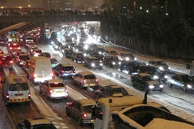
Inner Distribution Road
The snow seemed to particularly affect Northern Hampshire and Berkshire on this evening. This is the Inner Distribution Road, that is not distributing anything this evening. People I met later said they spent three hours travelling half an mile by car. Walking was definitely the best option.
Location:51.4546820, -0.9788350
Road:A329
Date:21 12 2009
Photographer:� Copyright Graham Horn and licensed for reuse under this Creative Commons Licence
Source:Geograph

Map

Y btmleft.gifY btmright.gif

Galleries  | A329 | Reading

File history

Click on a date/time to view the file as it appeared at that time.

Date/TimeThumbnailDimensionsUserComment
current16:49, 8 March 2010Thumbnail for version as of 16:49, 8 March 2010640 × 427 (194 KB)Jeni (talk | contribs)'''Inner Distribution Road'''<br/>The snow seemed to particularly affect Northern Hampshire and Berkshire on this evening. This is the Inner Distribution Road, that is not distributing anything this evening. People I met later said they spent three hour

The following page uses this file:

Metadata

SABRE - The Society for All British and Irish Road Enthusiasts
Discuss - Digest - Discover - Help