File:Landslide on Graig Road between Godre'r... (C) Nigel Davies - Geograph - 1482736.jpg
Jump to navigation
Jump to search

No higher resolution available.
Landslide_on_Graig_Road_between_Godre'r..._(C)_Nigel_Davies_-_Geograph_-_1482736.jpg (640 × 480 pixels, file size: 94 KB, MIME type: image/jpeg)
| |||||||||||||||||||||||||
|
Galleries | A4068 (Morriston - Ystalyfera) | Abandoned Road | ||
File history
Click on a date/time to view the file as it appeared at that time.
| Date/Time | Thumbnail | Dimensions | User | Comment | |
|---|---|---|---|---|---|
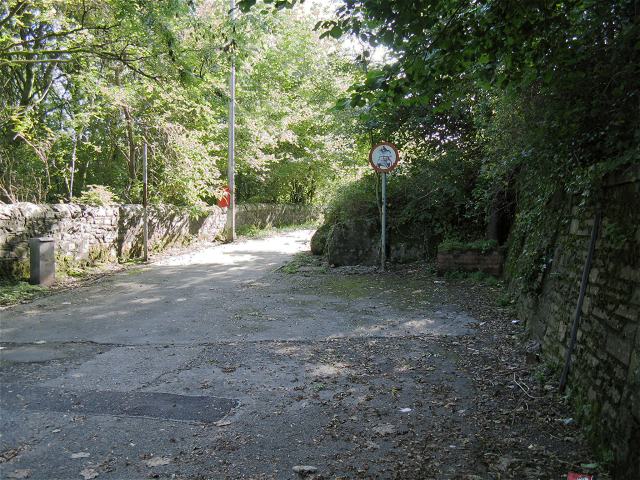
| current | 19:33, 23 August 2014 | | 640 × 480 (94 KB) | Vlad (talk | contribs) | '''Landslide on Graig Road between Godre'r... (C) Nigel Davies '''<br/>In 1965 part of Mynydd Allt-y-grug slipped down over this section of road sweeping away all the houses either side of it. The road has only ever been reopened as a much narrower pat... |
File usage
The following 3 pages use this file:
_Nigel_Davies_-_Geograph_-_1482736.jpg&oldid=384004)