File:Loampit Vale - Geograph - 96619.jpg

From Roader's Digest: The SABRE Wiki
Jump to navigation Jump to search

Loampit_Vale_-_Geograph_-_96619.jpg(640 × 480 pixels, file size: 152 KB, MIME type: image/jpeg)

Y topleft.gifY topright.gif
Description:
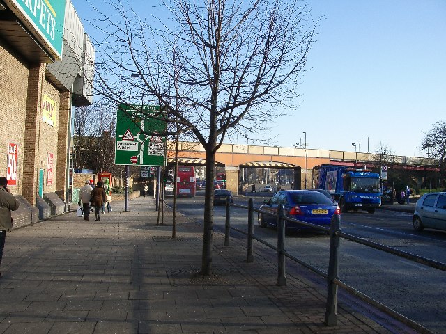
Loampit Vale
Not quite the rural idyll the name suggests; Loampit Vale is part of the A20 trunk road through south London. Here we are looking south-east along the road towards Lewisham station. The River Ravensbourne is flowing north more-or-less under the green sign.
Location:51.464379, -0.016241
Road:A20, A21
Date:28 12 2005
Photographer:� Copyright John Davies and licensed for reuse under this Creative Commons Licence
Source:Geograph

Map

Y btmleft.gifY btmright.gif

Galleries  | A20 | A21 | Loampit Vale | Loampit Vale | S3 | Roundabout

File history

Click on a date/time to view the file as it appeared at that time.

Date/TimeThumbnailDimensionsUserComment
current19:57, 29 August 2010Thumbnail for version as of 19:57, 29 August 2010640 × 480 (152 KB)Bob@romiley1 (talk | contribs)'''Loampit Vale'''<br/>Not quite the rural idyll the name suggests; Loampit Vale is part of the A20 trunk road through south London. Here we are looking south-east along the road towards Lewisham station. The River Ravensbourne is flowing north more-or-l

Metadata

SABRE - The Society for All British and Irish Road Enthusiasts
Discuss - Digest - Discover - Help