File:Misty morning, A41, Kings Langley - Geograph - 658857.jpg

From Roader's Digest: The SABRE Wiki
Jump to navigation Jump to search

Misty_morning,_A41,_Kings_Langley_-_Geograph_-_658857.jpg(640 × 480 pixels, file size: 183 KB, MIME type: image/jpeg)

Y topleft.gifY topright.gif
Description:
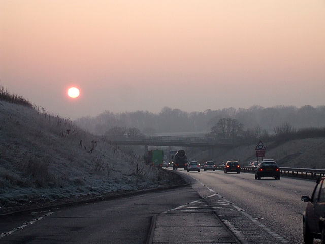
Misty morning, A41, Kings Langley
Taken from the last lay-by on the A41 going southeast before reaching the M25 roundabout (Junction 20) - the triangular warning sign for this roundabout can be clearly seen in the central reservation. The bridge ahead carries the very minor no-through-road called Langley Lodge Lane.
Location:51.7038630, -0.4539930
Road:A41
Date:20 12 2007
Photographer:� Copyright Rob Farrow and licensed for reuse under this Creative Commons Licence
Source:Geograph

Map

Y btmleft.gifY btmright.gif

Galleries  | A41

File history

Click on a date/time to view the file as it appeared at that time.

Date/TimeThumbnailDimensionsUserComment
current12:12, 8 April 2010Thumbnail for version as of 12:12, 8 April 2010640 × 480 (183 KB)Sabristo simon (talk | contribs)'''Misty morning, A41, Kings Langley'''<br/>Taken from the last lay-by on the A41 going southeast before reaching the M25 roundabout (Junction 20) - the triangular warning sign for this roundabout can be clearly seen in the central reservation. The bridge

The following page uses this file:

Metadata

SABRE - The Society for All British and Irish Road Enthusiasts
Discuss - Digest - Discover - Help