File:Mynachdy Interchange River Route.png
Jump to navigation
Jump to search

No higher resolution available.
Mynachdy_Interchange_River_Route.png (800 × 554 pixels, file size: 88 KB, MIME type: image/png)
| |||||||||||||||||||||||||
|
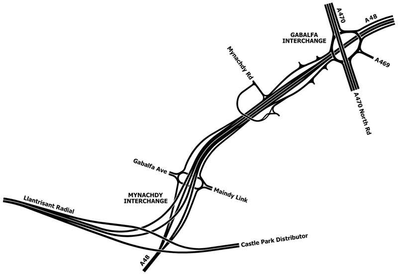
Galleries | A48 | A470 | A48(M) (Llantrisant Radial) | Cardiff | Gabalfa Interchange | ||
File history
Click on a date/time to view the file as it appeared at that time.
| Date/Time | Thumbnail | Dimensions | User | Comment | |
|---|---|---|---|---|---|
| current | 10:57, 14 August 2014 | | 800 × 554 (88 KB) | Truvelo (talk | contribs) | terrible aliasing |
File usage
The following 4 pages use this file: