File:N10 split - Coppermine - 10322.jpg
Jump to navigation
Jump to search

Size of this preview: 800 × 580 pixels. Other resolution: 1,024 × 743 pixels.
Original file (1,024 × 743 pixels, file size: 100 KB, MIME type: image/jpeg)
| |||||||||||||||||||||||||
|
Galleries | N9 | N10 | R448 | Advance Direction Sign | Bilingual signs | Speed limit sign/50 km/h | S2 | TOTSO | Kilkenny | ||
File history
Click on a date/time to view the file as it appeared at that time.
| Date/Time | Thumbnail | Dimensions | User | Comment | |
|---|---|---|---|---|---|
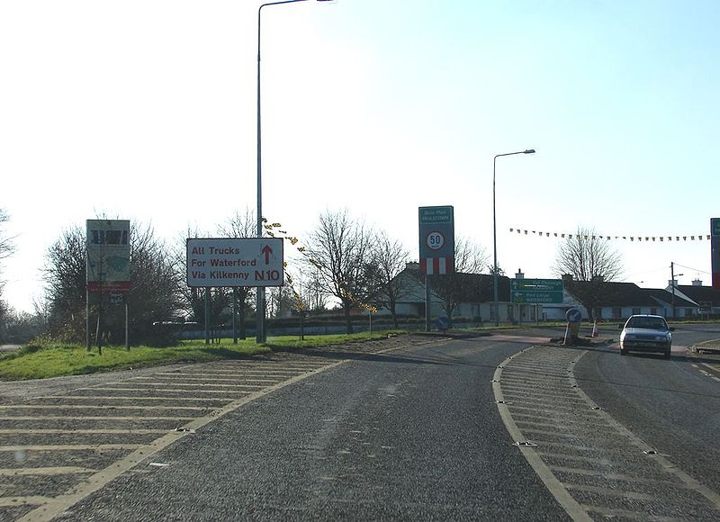
| current | 10:40, 9 June 2010 | | 1,024 × 743 (100 KB) | Bob@romiley1 (talk | contribs) | '''Approaching the N9/N10 split''' Heading southbound, we approach the TOTSO for the N9/N10 split at Paulstown. Trucks for Waterford are directed via Kilkenny and the N10, presumably to avoid the narrow streets of Thomastown, which lies further south on |
File usage
The following 2 pages use this file: