File:New Welsh Highland Railway track at Porthmadog - Geograph - 865716.jpg

From Roader's Digest: The SABRE Wiki
Jump to navigation Jump to search

New_Welsh_Highland_Railway_track_at_Porthmadog_-_Geograph_-_865716.jpg(640 × 480 pixels, file size: 161 KB, MIME type: image/jpeg)

Y topleft.gifY topright.gif
Description:
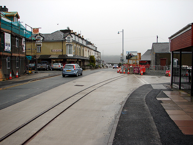
New Welsh Highland Railway track at Porthmadog
The new Welsh Highland Railway track curves from Britannia Bridge towards Harbour Station. The track has been let into the road, tramway style, so as to allow dual use of the road. It will be interesting to see how much disruption is caused to road traffic when the trains are running.
Location:52.924219, -4.126827
Road:A487
Date:27 06 2008
Photographer:� Copyright OLU and licensed for reuse under this Creative Commons Licence
Source:Geograph

Map

Y btmleft.gifY btmright.gif

Galleries  | A487 | Porthmadog

File history

Click on a date/time to view the file as it appeared at that time.

Date/TimeThumbnailDimensionsUserComment
current12:56, 21 March 2010Thumbnail for version as of 12:56, 21 March 2010640 × 480 (161 KB)Jeni (talk | contribs)'''New Welsh Highland Railway track at Porthmadog'''<br/>The new Welsh Highland Railway track curves from Britannia Bridge towards Harbour Station. The track has been let into the road, tramway style, so as to allow dual use of the road. It will be intere

The following 3 pages use this file:

Metadata

SABRE - The Society for All British and Irish Road Enthusiasts
Discuss - Digest - Discover - Help