No higher resolution available.
 | |  |
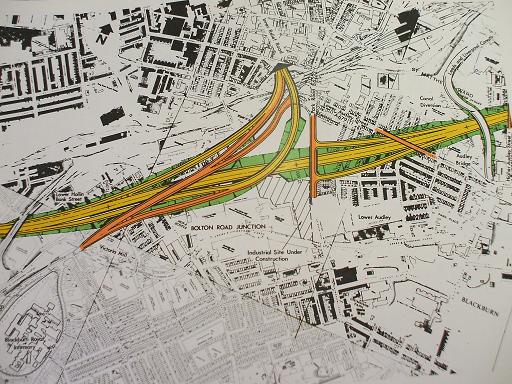
| | Description: | Nova Scotia Interchange engineering diagram | | Location: | This picture currently has no coords, edit this page to add them. | | Road: | M65 | | Date: | 2008 | | Photographer: | Bryn Buck | | Source: | Lancashire County Records Office |
| |
 | |  |
File history
Click on a date/time to view the file as it appeared at that time.
| Date/Time | Thumbnail | Dimensions | User | Comment |
|---|
| current | 20:47, 19 July 2009 |  | 512 × 384 (80 KB) | Bryn666 (talk | contribs) | {{Information |description = Nova Scotia Interchange engineering diagram |day = |month = |year = |photographer = Bryn Buck |source = Lancashire County Records Office |road |
File usage
The following 3 pages use this file:
This file contains additional information, probably added from the digital camera or scanner used to create or digitise it.
If the file has been modified from its original state, some details may not fully reflect the modified file.
