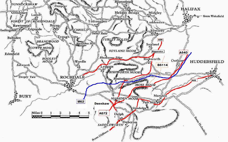
Fragment of map based on 2 seperate C18th maps, this map details the 'ancient highways' of the Pennines.
Some are easy to identify, others lost forever. Some bits of these routes are now A Roads, others bridleways and footpaths. I've painted over the 4 current turnpike routes of the South Pennines plus the M62.
Thanks to the South Pennine Packhorse Trails Trust for use of the map, where the original can be found without my scribbles all over it.
Originally uploaded to Coppermine on Apr 05, 2008 by Schult
'''Packhorse route map'''
Fragment of map based on 2 seperate C18th maps, this map details the 'ancient highways' of the Pennines.
Some are easy to identify, others lost forever. Some bits of these routes are now A Roads, others bridleways and foot...
