File:Poole Road Bridge - Geograph - 356852.jpg

From Roader's Digest: The SABRE Wiki
Jump to navigation Jump to search

Poole_Road_Bridge_-_Geograph_-_356852.jpg(640 × 428 pixels, file size: 96 KB, MIME type: image/jpeg)

Y topleft.gifY topright.gif
Description:
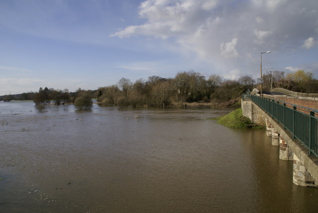
Poole Road Bridge
The main Wimborne to Poole Road crosses the River Stour on this bridge. The carriageway is restricted and a pedestrian walkway is hung on the side of the original bridge. In the centre of the picture is the confluence of the Rivers Stour and Allen.The shot was taken following heavy rain that had led to the rivers bursting their banks.
Location:50.792544, -1.978383
Road:B3073
Date:07 03 2007
Photographer:� Copyright Brian Ironside and licensed for reuse under this Creative Commons Licence
Source:Geograph

Map

Y btmleft.gifY btmright.gif

Galleries  | B3073

File history

Click on a date/time to view the file as it appeared at that time.

Date/TimeThumbnailDimensionsUserComment
current15:47, 10 May 2010Thumbnail for version as of 15:47, 10 May 2010640 × 428 (96 KB)Bob@romiley1 (talk | contribs)'''Poole Road Bridge'''<br/>The main Wimborne to Poole Road crosses the River Stour on this bridge. The carriageway is restricted and a pedestrian walkway is hung on the side of the original bridge. In the centre of the picture is the confluence of the Ri

The following 3 pages use this file:

Metadata

SABRE - The Society for All British and Irish Road Enthusiasts
Discuss - Digest - Discover - Help