File:St.Helier Tunnel, St.Helier Jersey - Coppermine - 18283.jpg
Jump to navigation
Jump to search

Size of this preview: 440 × 600 pixels. Other resolution: 485 × 661 pixels.
Original file (485 × 661 pixels, file size: 96 KB, MIME type: image/jpeg)
| |||||||||||||||||||||||||
|
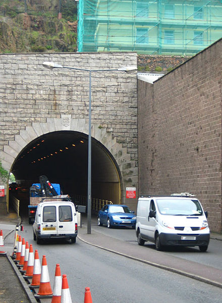
Galleries | A17 (Jersey) | St Helier | Jersey | St Helier Tunnel | ||
File history
Click on a date/time to view the file as it appeared at that time.
| Date/Time | Thumbnail | Dimensions | User | Comment | |
|---|---|---|---|---|---|
| current | 14:43, 28 March 2010 | | 485 × 661 (96 KB) | Sabristo simon (talk | contribs) | '''St.Helier Tunnel, St.Helier Jersey''' The A17 road goes right through a tunnel under the rocky terrain of Fort Regent saving drivers from the nightmare of going up and down steep hills! <small>''Originally uploaded to Coppermine on Jun 04, 2008 by Do |
File usage
The following 4 pages use this file: