File:The A33, Reading - Geograph - 604114.jpg

From Roader's Digest: The SABRE Wiki
Jump to navigation Jump to search

The_A33,_Reading_-_Geograph_-_604114.jpg(640 × 480 pixels, file size: 137 KB, MIME type: image/jpeg)

Y topleft.gifY topright.gif
Description:
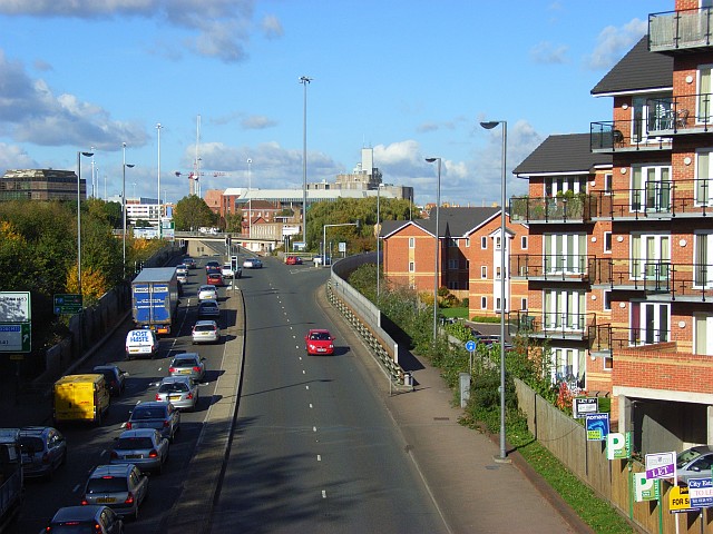
The A33, Reading
Queuing traffic as it reaches its junction with the Inner Distribution Road, the A329. This road has replaced Basingstoke Road, now the B3031, as the main route into the town from the south.
Location:51.448820, -0.976807
Road:A33
Date:30 10 2007
Photographer:� Copyright Andrew Smith and licensed for reuse under this Creative Commons Licence
Source:Geograph

Map

Y btmleft.gifY btmright.gif

Galleries  | A33 | Reading

File history

Click on a date/time to view the file as it appeared at that time.

Date/TimeThumbnailDimensionsUserComment
current16:47, 8 March 2010Thumbnail for version as of 16:47, 8 March 2010640 × 480 (137 KB)Jeni (talk | contribs)'''The A33, Reading'''<br/>Queuing traffic as it reaches its junction with the Inner Distribution Road, the A329. This road has replaced Basingstoke Road, now the B3031, as the main route into the town from the south.

The following page uses this file:

Metadata

SABRE - The Society for All British and Irish Road Enthusiasts
Discuss - Digest - Discover - Help