File:The Broadway, Dudley - Geograph - 1982927.jpg

From Roader's Digest: The SABRE Wiki
Jump to navigation Jump to search

The_Broadway,_Dudley_-_Geograph_-_1982927.jpg(640 × 456 pixels, file size: 84 KB, MIME type: image/jpeg)

Y topleft.gifY topright.gif
Description:
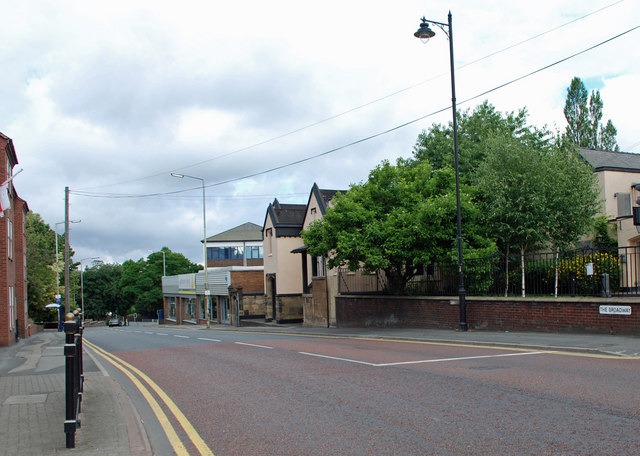
The Broadway, Dudley
View in the direction of Dudley College from the corner of Castle Street. On the 1901 Ordnance Survey map this section of The Broadway was named as Downing Street. Possibly named after Francis Downing, Mayor of Dudley in 1818/19 and 1831.
Location:52.512450, -2.082030
Road:A459, Dudley Tour
Date:25 07 2010
Photographer:� Copyright Brian Clift and licensed for reuse under this Creative Commons Licence
Source:Geograph

Map

Y btmleft.gifY btmright.gif

Galleries  | A459 | Dudley Tour | Dudley

File history

Click on a date/time to view the file as it appeared at that time.

Date/TimeThumbnailDimensionsUserComment
current22:25, 19 August 2010Thumbnail for version as of 22:25, 19 August 2010640 × 456 (84 KB)Steven (talk | contribs)'''The Broadway, Dudley'''<br/>View in the direction of Dudley College from the corner of Castle Street. On the 1901 Ordnance Survey map this section of The Broadway was named as Downing Street. Possibly named after Francis Downing, Mayor of Dudley in

The following page uses this file:

Metadata

SABRE - The Society for All British and Irish Road Enthusiasts
Discuss - Digest - Discover - Help