File:The M2 at Fortwilliam - Geograph - 272921.jpg

From Roader's Digest: The SABRE Wiki
Jump to navigation Jump to search

The_M2_at_Fortwilliam_-_Geograph_-_272921.jpg(640 × 426 pixels, file size: 135 KB, MIME type: image/jpeg)

Y topleft.gifY topright.gif
Description:
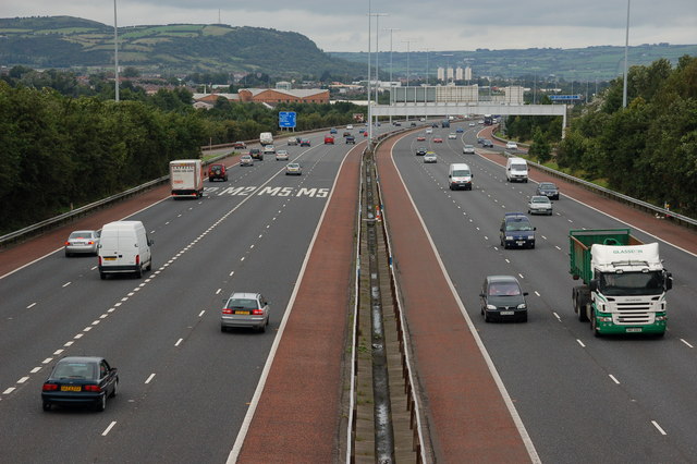
The M2 at Fortwilliam
The building of the foreshore section of the M2 between Whitla Street, Belfast and Greencastle was a major civil engineering project. It involved reclamation of a large part of Belfast Lough and the transport of more than 4 million tons of fill, by rail, from Magheramorne near Larne. Work started in 1966 with the road opening in 1973. This is the view north from the overbridge at Fortwilliam. The landscaping has taken well although it is hard to hide a motorway! Those with an interest in such things will note the additional hard shoulder on the inside. This section of road carries more than 90,000 vehicles each day.
Location:54.627578, -5.918589
Road:M2 (Northern Ireland), T7 (Northern Ireland) , E01
Date:05 09 2006
Photographer:� Copyright Albert Bridge and licensed for reuse under this Creative Commons Licence
Source:Geograph

Map

Y btmleft.gifY btmright.gif

Galleries  | M2 (Northern Ireland) | T7 (Northern Ireland) | E01 | Fortwilliam Roundabout | Belfast | E16 | E18

File history

Click on a date/time to view the file as it appeared at that time.

Date/TimeThumbnailDimensionsUserComment
current12:34, 16 June 2010Thumbnail for version as of 12:34, 16 June 2010640 × 426 (135 KB)Si404 (talk | contribs)'''The M2 at Fortwilliam'''<br/>The building of the foreshore section of the M2 between Whitla Street, Belfast and Greencastle was a major civil engineering project. It involved reclamation of a large part of Belfast Lough and the transport of more than

Metadata

SABRE - The Society for All British and Irish Road Enthusiasts
Discuss - Digest - Discover - Help