File:The TT Grandstand Area - Isle of Man - Geograph - 31739.jpg

From Roader's Digest: The SABRE Wiki
Jump to navigation Jump to search

The_TT_Grandstand_Area_-_Isle_of_Man_-_Geograph_-_31739.jpg(640 × 480 pixels, file size: 108 KB, MIME type: image/jpeg)

Y topleft.gifY topright.gif
Description:
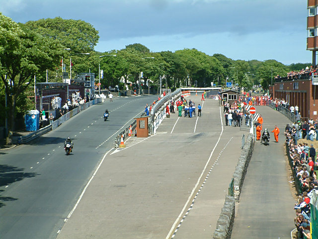
The TT Grandstand Area - Isle of Man
This was taken from the footbridge over the course during one of the races in the 2004 festival. The actual grandstand is just about out of shot to the right, but the track and pit areas are visible.
Location:54.167815, -4.475411
Road:A2 (Isle of Man)
Date:05 06 2004
Photographer:� Copyright Jon Wornham and licensed for reuse under this Creative Commons Licence
Source:Geograph

Map

Y btmleft.gifY btmright.gif

Galleries  | A2 (Isle of Man) | Douglas | TT Circuit

File history

Click on a date/time to view the file as it appeared at that time.

Date/TimeThumbnailDimensionsUserComment
current17:05, 28 May 2010Thumbnail for version as of 17:05, 28 May 2010640 × 480 (108 KB)Abeaton (talk | contribs)'''The TT Grandstand Area - Isle of Man'''<br/>This was taken from the footbridge over the course during one of the races in the 2004 festival. The actual grandstand is just about out of shot to the right, but the track and pit areas are visible.

The following 3 pages use this file:

Metadata

SABRE - The Society for All British and Irish Road Enthusiasts
Discuss - Digest - Discover - Help