File:The Westlink, Belfast (21) - Geograph - 873408.jpg
Jump to navigation
Jump to search

No higher resolution available.
The_Westlink,_Belfast_(21)_-_Geograph_-_873408.jpg (640 × 424 pixels, file size: 90 KB, MIME type: image/jpeg)
| |||||||||||||||||||||||||
|
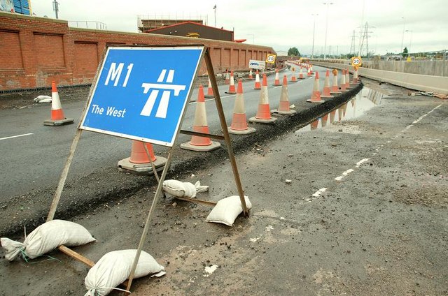
Galleries | M1 (Northern Ireland) | Belfast | Chopsticks | Roadworks | Broadway Roundabout (Belfast) | ||
File history
Click on a date/time to view the file as it appeared at that time.
| Date/Time | Thumbnail | Dimensions | User | Comment | |
|---|---|---|---|---|---|
| current | 12:00, 4 May 2010 | | 640 × 424 (90 KB) | Si404 (talk | contribs) | '''The Westlink, Belfast (21)'''<br/>See <a href="http://www.geograph.org.uk/photo/873380">J3273 : The Westlink, Belfast (20)</a>. What was the start of the M1 is now a slip road temporarily reduced to one lane. The new third lanes to and from the junc |
File usage
There are no pages that use this file.
_-_Geograph_-_873408.jpg&oldid=619661)