File:Thickthorn.png
Jump to navigation
Jump to search

No higher resolution available.
Thickthorn.png (472 × 355 pixels, file size: 4 KB, MIME type: image/png)
| |||||||||||||||||||||||||
|
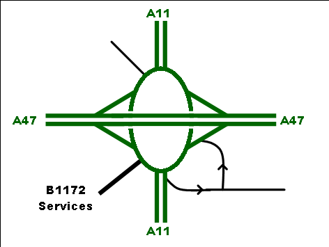
Galleries | A11 | A47 | B1172 (Wymondham - Cringleford) | ||
File history
Click on a date/time to view the file as it appeared at that time.
| Date/Time | Thumbnail | Dimensions | User | Comment | |
|---|---|---|---|---|---|
| current | 11:15, 18 April 2013 | | 472 × 355 (4 KB) | Michaos (talk | contribs) | Higher resolution |
| 10:48, 18 April 2013 |  | 236 × 178 (2 KB) | Michaos (talk | contribs) | A strip-map of Thickthorn Interchange, present day. |
File usage
The following 3 pages use this file: