File:Town Bridge, Sturminster Newton - Geograph - 1318978.jpg

From Roader's Digest: The SABRE Wiki
Jump to navigation Jump to search

Town_Bridge,_Sturminster_Newton_-_Geograph_-_1318978.jpg(640 × 427 pixels, file size: 376 KB, MIME type: image/jpeg)

Y topleft.gifY topright.gif
Description:
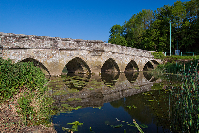
Town Bridge, Sturminster Newton
This 6 arch bridge spans the River Stour a few hundred yards downstream from the more iconic Sturminster Mill. However, with its grade I listed status, it carries more weight (if you'll pardon the pun) than its near neighbour, and is of course much older, dating from circa 1500. It was widened in the C17, and this included corbelling over the central arches to provide pedestrian refuges.
Location:50.921452, -2.307816
Road:B3092
Date:24 05 2009
Photographer:� Copyright Mike Searle and licensed for reuse under this Creative Commons Licence
Source:Geograph

Map

Y btmleft.gifY btmright.gif

Galleries  | B3092 | Town Bridge (Sturminster Newton) | Pictures from Geograph

File history

Click on a date/time to view the file as it appeared at that time.

Date/TimeThumbnailDimensionsUserComment
current17:10, 10 May 2010Thumbnail for version as of 17:10, 10 May 2010640 × 427 (376 KB)Bob@romiley1 (talk | contribs)'''Town Bridge, Sturminster Newton'''<br/>This 6 arch bridge spans the River Stour a few hundred yards downstream from the more iconic Sturminster Mill. However, with its grade I listed status, it carries more weight (if you'll pardon the pun) than its ne

The following page uses this file:

Metadata

SABRE - The Society for All British and Irish Road Enthusiasts
Discuss - Digest - Discover - Help