File:Ty Nant cutting opening plaque 2.jpg

From Roader's Digest: The SABRE Wiki
Jump to navigation Jump to search

Original file(1,024 × 768 pixels, file size: 180 KB, MIME type: image/jpeg)

Y topleft.gifY topright.gif
Description:The opening plaque for the Ty Nant improvement, situated on the abandoned section of road.
Location:52.986267, -3.499576
Road:A5
Date:26 May 2009
Photographer:Jeni
Source:

Map

Y btmleft.gifY btmright.gif

Galleries  | A5 | Glyn Bends, Ty Nant

File history

Click on a date/time to view the file as it appeared at that time.

Date/TimeThumbnailDimensionsUserComment
current18:45, 26 May 2009Thumbnail for version as of 18:45, 26 May 20091,024 × 768 (180 KB)Jeni (talk | contribs)
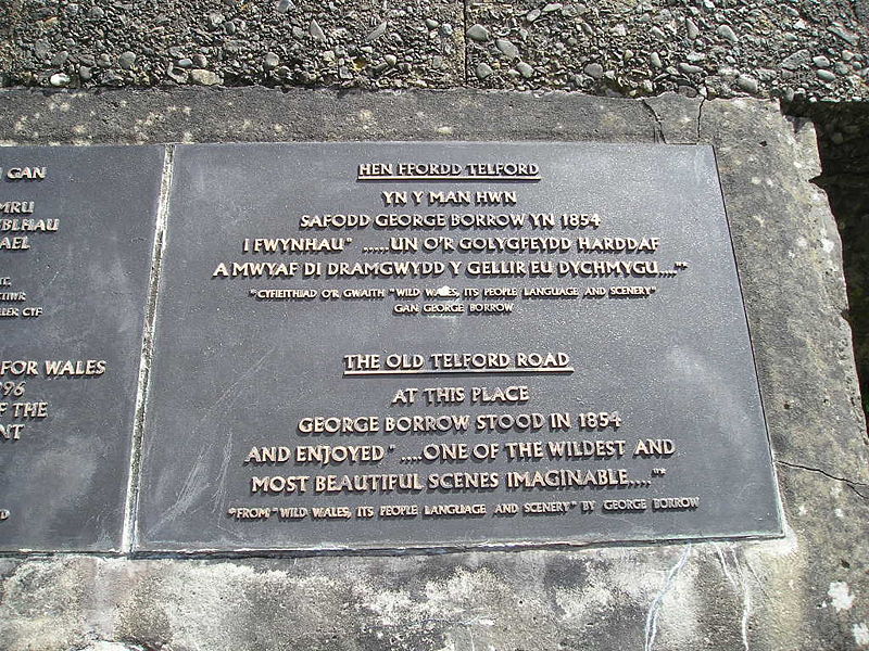
{{Information |description = The opening plaque for the Ty Nant improvement, situated on the abandoned section of road. |day = 26 |month = May |year = 2009 |photographer = Jeni |source = |road = A5 |la

There are no pages that use this file.

Metadata

SABRE - The Society for All British and Irish Road Enthusiasts
Discuss - Digest - Discover - Help