File:Village shop, Keash - Geograph - 1608512.jpg

From Roader's Digest: The SABRE Wiki
Jump to navigation Jump to search

Village_shop,_Keash_-_Geograph_-_1608512.jpg(640 × 480 pixels, file size: 84 KB, MIME type: image/jpeg)

Y topleft.gifY topright.gif
Description:
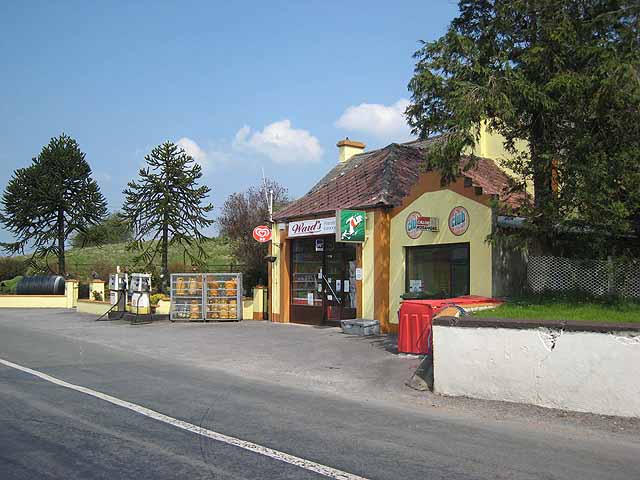
Village shop and petrol station, Keash Like many Irish villages, Keash is extremely scattered. The pub and shop are virtually the only buildings in the village which lie on the main road, some 500 metres away from the church and most of the rest of the housing.
Location:54.045522, -8.446303
Road:R295
Date:06 05 2008
Photographer:(c) Copyright Oliver Dixon and licensed for reuse under this Creative Commons Licence
Source:Geograph

Map

Y btmleft.gifY btmright.gif

Galleries  | R295 | Petrol station

File history

Click on a date/time to view the file as it appeared at that time.

Date/TimeThumbnailDimensionsUserComment
current19:00, 8 May 2016Thumbnail for version as of 19:00, 8 May 2016640 × 480 (84 KB)C2r (talk | contribs)'''Village shop and petrol station, Keash''' Like many Irish villages, Keash is extremely scattered. The pub and shop are virtually the only buildings in the village which lie on the main road, some 500 metres away from the church and most of the rest ...

The following 2 pages use this file:

Metadata

SABRE - The Society for All British and Irish Road Enthusiasts
Discuss - Digest - Discover - Help