File:Warburton Bridge, Manchester Ship Canal - Geograph - 53915.jpg

From Roader's Digest: The SABRE Wiki
Jump to navigation Jump to search

Warburton_Bridge,_Manchester_Ship_Canal_-_Geograph_-_53915.jpg(640 × 398 pixels, file size: 73 KB, MIME type: image/jpeg)

Y topleft.gifY topright.gif
Description:
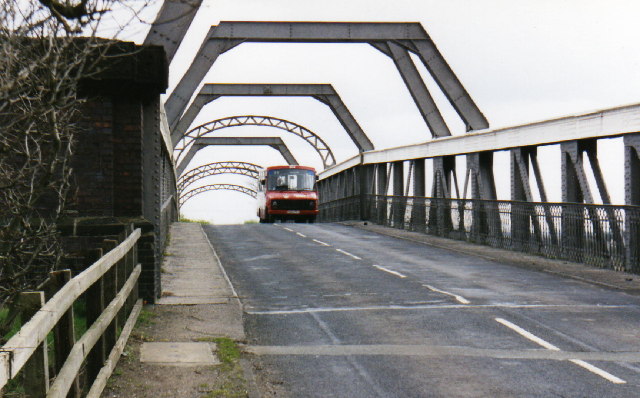
Warburton Bridge, Manchester Ship Canal
Toll bridge over the Manchester Ship Canal. This picture was taken during a Government-funded scheme to provide rural bus services. Warrington Borough Transport briefly ran a 35 route from Culcheth to Warburton, possibly the only bus route ever over the bridge.
Location:53.407550, -2.459358
Road:B5159
Date:1998
Photographer:� Copyright S Parish and licensed for reuse under this Creative Commons Licence
Source:Geograph

Map

Y btmleft.gifY btmright.gif

Galleries  | B5159 | S2 | Warburton Bridge

File history

Click on a date/time to view the file as it appeared at that time.

Date/TimeThumbnailDimensionsUserComment
current10:56, 24 March 2010Thumbnail for version as of 10:56, 24 March 2010640 × 398 (73 KB)Bob@romiley1 (talk | contribs)'''Warburton Bridge, Manchester Ship Canal'''<br/>Toll bridge over the Manchester Ship Canal. This picture was taken during a Government-funded scheme to provide rural bus services. Warrington Borough Transport briefly ran a 35 route from Culcheth to Warb

The following page uses this file:

Metadata

SABRE - The Society for All British and Irish Road Enthusiasts
Discuss - Digest - Discover - Help