File:Weyhill - Former Service Station - Geograph - 2268288.jpg
Jump to navigation
Jump to search

No higher resolution available.
Weyhill_-_Former_Service_Station_-_Geograph_-_2268288.jpg (640 × 480 pixels, file size: 56 KB, MIME type: image/jpeg)
| |||||||||||||||||||||||||
|
Galleries | a303 | ||
File history
Click on a date/time to view the file as it appeared at that time.
| Date/Time | Thumbnail | Dimensions | User | Comment | |
|---|---|---|---|---|---|
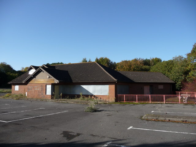
| current | 15:31, 2 May 2013 | | 640 × 480 (56 KB) | Pdb181 (talk | contribs) | Weyhill - Former A303 westbound Service Station This service station was closed in 2005 following a fire at the eastbound sister site on the opposite side of the A303. |
File usage
There are no pages that use this file.