File:Whitchurch Bridge, River Thames - Geograph - 509397.jpg
Jump to navigation
Jump to search

No higher resolution available.
Whitchurch_Bridge,_River_Thames_-_Geograph_-_509397.jpg (640 × 546 pixels, file size: 116 KB, MIME type: image/jpeg)
| |||||||||||||||||||||||||
|
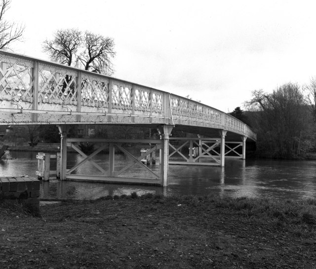
Galleries | B471 | Whitchurch Bridge | ||
File history
Click on a date/time to view the file as it appeared at that time.
| Date/Time | Thumbnail | Dimensions | User | Comment | |
|---|---|---|---|---|---|
| current | 15:45, 8 March 2010 | | 640 × 546 (116 KB) | Jeni (talk | contribs) | '''Whitchurch Bridge, River Thames'''<br/>The River Thames was fordable at this pint for many years, but after the construction of a pound lock in 1787 this was no longer the case, and the first bridge was built by private subscription, opening in 1793. |
File usage
There are no pages that use this file.