File:Woodhead Pass, A628 - Geograph - 1193982.jpg

From Roader's Digest: The SABRE Wiki
Jump to navigation Jump to search

Woodhead_Pass,_A628_-_Geograph_-_1193982.jpg(640 × 479 pixels, file size: 133 KB, MIME type: image/jpeg)

Y topleft.gifY topright.gif
Description:
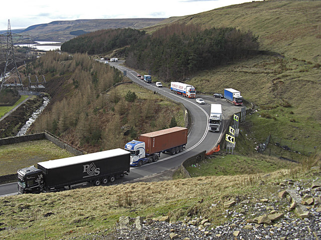
Woodhead Pass, A628
Looking from the Trans Pennine Trail. The A628 carries a lot of heavy traffic between Manchester and South Yorkshire. Here we see Yorkshire-bound traffic with one juggernaut crossing the double white lines on a severe bend. Possibly a homesick continental driver. The Longdendale Valley can be seen left of shot.
Location:53.496133, -1.830532
Road:A628
Date:05 03 2009
Photographer:� Copyright michael ely and licensed for reuse under this Creative Commons Licence
Source:Geograph

Map

Y btmleft.gifY btmright.gif

Galleries  | A628 | S2 | Woodhead Pass

File history

Click on a date/time to view the file as it appeared at that time.

Date/TimeThumbnailDimensionsUserComment
current17:19, 29 May 2010Thumbnail for version as of 17:19, 29 May 2010640 × 479 (133 KB)Ravenbluemoon (talk | contribs)'''Woodhead Pass, A628'''<br/>Looking from the Trans Pennine Trail. The A628 carries a lot of heavy traffic between Manchester and South Yorkshire. Here we see Yorkshire-bound traffic with one juggernaut crossing the double white lines on a severe bend. P

Metadata

SABRE - The Society for All British and Irish Road Enthusiasts
Discuss - Digest - Discover - Help