Gallery:Canterbury
The same ring road; this time the view when travelling from Margate towards Ashford, Tenterden and Hastings.
Originally uploaded to Coppermine on Jun 04, 2009 by agc2070Part of Canterbury's two thirds of a ring road, the A28 circumnavigates the city wall en route from Ashford to Margate.
Originally uploaded to Coppermine on Jun 04, 2009 by agc2070The approach to Canterbury from Margate direction
Originally uploaded to Coppermine on Jun 04, 2009 by agc2070Formerly part of the A2 London-Dover Road but bypassed in 1980, this stretch now carries the A28/A2050 multiplex. It was opened in 1969 and follows the course of an older narrow back road. It was built into the park that used to run alongside the city wall (also shown in this view). The bus lane has been added within the last 2 years by widening the carriageway on both sides
Originally uploaded to Coppermine on Nov 11, 2006 by Brenley CornerIt could be a picture from 1965 not 2005. These two ancient RAC signs direct traffic at the former junction of the A28 from Margate and the A2 London-Dover road in Canterbury High Street. The A2 & A28 were diverted away from the High Street with the building of the Ring Road in the second half of the 60's. The picture was taken with my mobile hence its lack of clarity. The signs say A2 Dover to the left, and A2 Chatham to the right.
Originally uploaded to Coppermine on Oct 02, 2005 by Brenley CornerThe A290 Canterbury-Whitstable road runs through the Westgate, built centuries ago and not really designed for road vehicles! Westbound traffic goes around, eastbound traffic goes through.
Originally uploaded to Coppermine on Apr 25, 2005 by Gareth ThomasDirections signs high up on a wall in Canterbury High Street where the old A28 from Margate met the A2.
Originally uploaded to Coppermine on May 11, 2006 by StevenThe old in the background, the new in the foreground.
Originally uploaded to Coppermine on Jan 29, 2006 by Gareth ThomasLocated at the University of Kent, Canterbury, where delivery traffic meets Parkwood Road.
Originally uploaded to Coppermine on Jan 29, 2006 by Gareth ThomasThis sign amuses me. On one hand it appears to cyclists where to ride, on the other it says Cyclists Dismount..... ;-) (It's really telling cyclists where the cycle lanes are). Note that they now have to dismount every day of the week instead of just Mon-Sat.
Originally uploaded to Coppermine on Jan 25, 2006 by Gareth ThomasThere are still plenty of Alpha 3's on the Canterbury Ring Road. Sadly this double column has been the victim of lighting vandalism and now possesses a Philips SGS203 and Alpha 3 on the same double column. In the foreground a pristine Alpha 3 (but this column is not currently working - likely to be a bulb failure)
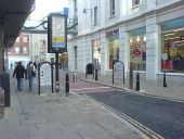
Originally uploaded to Coppermine on Nov 11, 2006 by Brenley CornerAn Alpha 3 on a n old column in the middle of a pedestrianised area of Canterbury - complete with old road signs mounted high on the wall dating back to when this was the A2 (prior 1963)
Originally uploaded to Coppermine on Mar 18, 2007 by Brenley CornerDuring w/c 5.03.07, the Alpha 3's along the Canterbury Ring Road were replaced with Philips Iridiums. What a shame........
Originally uploaded to Coppermine on Mar 10, 2007 by Brenley CornerAlmost all of the signal heads around Canterbury town centre are now 3Gs. They have a lovely bright 'snap' action.
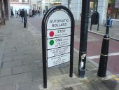
Originally uploaded to Coppermine on Jul 04, 2009 by horsetanThe accompanying sign next to the descending bollard at the entrance to a pedestrian area in Canterbury City Centre.
Originally uploaded to Coppermine on Nov 11, 2006 by Brenley CornerCanterbury City Centre. This bollard spends most of its time in the raised position only descending to let service vehicles and delivery vehicles into the Whitefriars pedestrian area. The sign next to it very clear: No Tailgating!! There are lights built into the top of the bollard. A separate photo shows the wording on the sign to the left.
Originally uploaded to Coppermine on Nov 11, 2006 by Brenley CornerThe Crab & Winkle Way is a cycle route which follows the path of an old railway line between Canterbury and Whitstable. It forms part of National Cycle Network route 1, which stretches from Dover to John o'Groats.
The blue marker on the post in the foreground indicates the route of National Cycle Network route 1, to John o'Groats. Cyclists use the pavement here rather than the road.
This view is of the corner of the Riding Gate roundabout on the A28?A2050 Canterbury Ring Road multiplex showing several ages of lighting. A single column Alpha 3, a bastardised double showing both Alpha 3 and SGS203 on the same column and a post-top SGS203 in the background. The Ring Road here dates from 1969 and some columns may well be original.
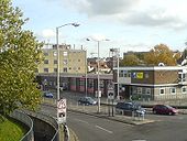
Originally uploaded to Coppermine on Nov 11, 2006 by Brenley CornerCanterbury West Railway Station entrance to left and Kirbys Lane to right.
These signs are high up on a shop frontage, and presumably out of reach of the local pre-Worboys warden!
Originally uploaded to Coppermine on Jun 11, 2006 by Simon A6(M)


