Gallery:A200
From Roader's Digest: The SABRE Wiki
Jump to navigation
Jump to search
A200-A299 > A200
This gallery has no child categories
A200
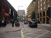
A200 Tooley Street at London Bridge
Here is the A200 at Tooley Street. This picture was taken on a bridge leading towards London Bridge railway station hence the blured look to the picture.. As it was half term, there is a massive queue for the London Dungtion. The road itself is quite quiet. As for London Bridge itself is the Zone 2/3/4 Border. London Bridge is also the only London Underground Station with the word London in its name.
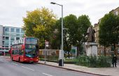
Originally uploaded to Coppermine on Oct 25, 2006 by ABeatonQueen Elizabeth Street (C) Martin Addison
This short section of the street, to the west of Tower Bridge Road, connects to Tooley Street on the right of the photo. The street is used by buses terminating at City Hall. The 343 route runs to New Cross and is currently served by Wright bodied Volvo buses belonging to Abellio.
This short section of the street, to the west of Tower Bridge Road, connects to Tooley Street on the right of the photo. The street is used by buses terminating at City Hall. The 343 route runs to New Cross and is currently served by Wright bodied Volvo buses belonging to Abellio.
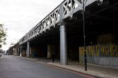
Druid Street (C) Martin Addison
This Bermondsey street runs parallel with the railway line into London Bridge station for around 3/4km from Jamaica Road to the St.Olaves Estate, crossing Tower Bridge Road midway. The railway is carried above the atreets on a mixture of brick arches and bridges like the steel girder constructuion in this photo. The mix of construction methods is probably due to widening of the trackbed and possibly the complexity of the arrangement of sidestreets being crossed at this point. Whites Grounds on the right is now a skateboard park under the arches but was one of three sidestreets passing under the railway at this point at varying angles.
This Bermondsey street runs parallel with the railway line into London Bridge station for around 3/4km from Jamaica Road to the St.Olaves Estate, crossing Tower Bridge Road midway. The railway is carried above the atreets on a mixture of brick arches and bridges like the steel girder constructuion in this photo. The mix of construction methods is probably due to widening of the trackbed and possibly the complexity of the arrangement of sidestreets being crossed at this point. Whites Grounds on the right is now a skateboard park under the arches but was one of three sidestreets passing under the railway at this point at varying angles.
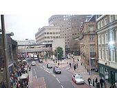
London- St. Thomas Street (C) Dr Neil Clifton
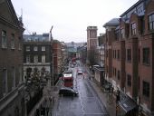
Looking west from the footbridge leading from London Bridge Station to Guy's Hospital. A visit to the Old Operating Theatre Museum (on the right hand side of St. Thomas Street) will make you very grateful for today's NHS, in spite of its perceived limitations.
Looking west from the footbridge leading from London Bridge Station to Guy's Hospital. A visit to the Old Operating Theatre Museum (on the right hand side of St. Thomas Street) will make you very grateful for today's NHS, in spite of its perceived limitations.
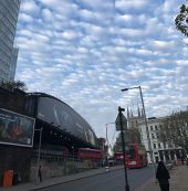
It's the end of the road for the A200. Turn left or right for the A3. Except you can't cross London Bridge anymore unless you are authorised by our TFL overlords. Major route out of London for hundreds of years? Get lost! Oh and this bit isn't actually Tooley Street, that turned off and is headed under the bridge. Sorry.
Hidden categories:
