Gallery:A225

From Roader's Digest: The SABRE Wiki
Jump to navigation Jump to search
A200-A299 > A225


This gallery has no child categories
A225
 
 
M25 over A225 Hawley Road.jpg
M25 over A225 Hawley Road
Old road sign on the Dartford bypass.jpg
Old road sign on the Dartford bypass
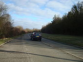
Eynsford Road - Geograph - 1706231.jpg
Eynsford Road
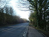
Shoreham Road (A225), near Shoreham - Geograph - 1706224.jpg
Shoreham Road (A225), near Shoreham
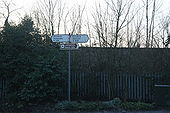
Road sign on the A225 - Geograph - 1735548.jpg
Road sign on the A225
Speed warning sign on the A225 - Geograph - 1735542.jpg
Speed warning sign on the A225
Sign in Sevenoaks, Kent - Coppermine - 6359.jpg
Sign in Sevenoaks, Kent

The B2019 isn't signed at its other end, ie its junction with the A25, to encourage traffic to avoid what is now a residential street. It still cuts the corner off, of course.

Originally uploaded to Coppermine on Jun 11, 2006 by Simon A6(M)
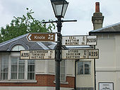
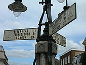
Old fingerposts in Sevenoaks town centre - Coppermine - 6358.jpg
Old fingerposts in Sevenoaks town centre

Note the blanked-out 'A21' on two of the posts. This used to be a major bottleneck on the London-Hastings road, now renumbered as A225. Pleasing that somebody considered the old sign too attractive to uproot.

Originally uploaded to Coppermine on Jun 11, 2006 by Simon A6(M)
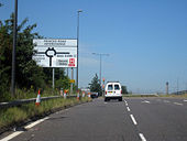
Princes Road Interchange.jpg
Princes Road Interchange
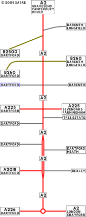
1st Dartford By-Pass.png
A strip map of the 1st Dartford Bypass as it is today.
1st Dartford By-Pass 1924.PNG
A strip map of the 1st Dartford Bypass as it was upon opening in November 1924.
1st Dartford By-Pass 1972.PNG
This is the First Dartford Bypass as it was in 1972.
1st Dartford By-Pass 1978.png
This is the First Dartford Bypass as it was in 1978.
1st Dartford By-Pass 1988.png
This is the First Dartford Bypass as it was in 1988.
1st Dartford By-Pass 1991.png
This is the First Dartford Bypass as it was in 1991.
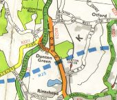
M25 - Coppermine - 173.jpg
M25

Robemptystage Originally uploaded to Coppermine on Mar 30, 2005 by M4Simon

This page includes a scan of a non-free copyrighted map, and the copyright for it is most likely held by the company or person that produced the map. It is believed that the use of a limited number of web-resolution scans qualifies as fair use under United States copyright law, where this web page is hosted, as such display does not significantly impede the right of the copyright holder to sell the copyrighted material, is not being used to generate profit in this context, and presents information that cannot be exhibited otherwise.
If the copyright holder considers this is an infringement of their rights, please contact the Site Management Team to discuss further steps.

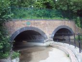
Princes Tunnel in 2014.JPG
A view of the tunnel with the Western Bore as a part of the Darent Valley Path.
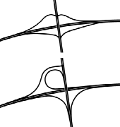
Otford Road Interchange.png
Two layouts for a possible junction at Otford Road as proposed in 1976.
Farmland by the A20 Main Road at Farningham, Kent - Geograph - 2272151.jpg
Farmland by the A20 Main Road at Farningham, Kent This shows farmland by the Farningham by-pass in the Darent valley before the building of the M20 motorway. The photographer position is probably close to the present course of the motorway.

Ahead is the A20 to West Kingsdown, Wrotham, Maidstone, Ashford and Dover. Left is the A225 to Dartford. Right is Dartford Road in to Farningham Village. I seem to remember picking out big and knobbly flints from the edge of this field to take back to the Midlands as specimens.

The image is circa 1970-1972, scanned from unbranded monochrome negative film.
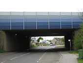
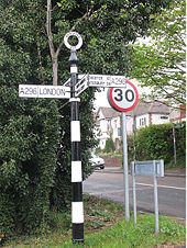
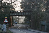
Railway Bridge over the A225, Eynsford Station - Geograph - 1735547.jpg
Railway Bridge over the A225, Eynsford Station
 

SABRE - The Society for All British and Irish Road Enthusiasts
Discuss - Digest - Discover - Help