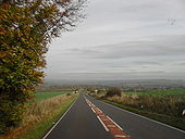
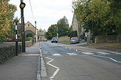
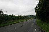
Gallery:A361

From Roader's Digest: The SABRE Wiki
Jump to navigation Jump to search
A300-A399 > A361


This gallery has no child categories
A361
 
 
A361 Speed Limits - Coppermine - 23113.jpg
A361 Speed Limits

A new sign on the NDLR at Tiverton reminding drivers of their speed limits. For a substantial percentage of drivers, this is the first single carriageway road in their journey for several hunderad miles.

Originally uploaded to Coppermine on Sep 12, 2009 by DavidBrown
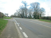
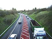
A39 (soon to be A361) near Barnstaple - Coppermine - 9454.jpg
A39 (soon to be A361) near Barnstaple

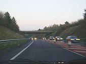
A part of the A39 outside of Barnstaple where a 2+1 arrangement has given way to this, where the centre lane has been hashed out and hazard posts along the sides.

Originally uploaded to Coppermine on Dec 08, 2006 by RichieGraham
B3227-wivels1.jpg
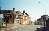
Traffic lights at the junction with the B3227 and High Street in Wiveliscombe
B3090-market.jpg
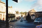
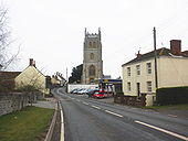
The B3090 passing through Fromes Market Place
Old-a39-glast.jpg
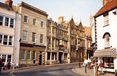
Part of the former A39/A361 multiplex along Glastonbury High Street
Tiverton - Aerial View - Geograph - 1282944.jpg
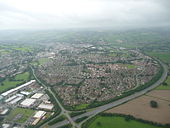
Tiverton : Aerial View
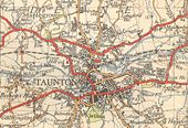
Taunton-1946.jpg
Taunton in 1946 This page contains scans from a map that is believed may be out of copyright according to UK Crown Copyright, UK Copyright Law for other maps published in the United Kingdom, or Irish Government Copyright, is not being used to generate profit in this context, and presents information that cannot be exhibited otherwise.
If the copyright holder considers this is an infringement of their rights, please contact the site management team to discuss further steps.
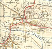
Glastonbury-1946.jpg
Glastonbury in 1946, showing the bypass as a railway line still! Also showing Street before its relief road was built. This page contains scans from a map that is believed may be out of copyright according to UK Crown Copyright, UK Copyright Law for other maps published in the United Kingdom, or Irish Government Copyright, is not being used to generate profit in this context, and presents information that cannot be exhibited otherwise.
If the copyright holder considers this is an infringement of their rights, please contact the site management team to discuss further steps.
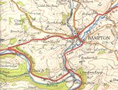
Bampton-1946.jpg
Bampton in 1946, with the A361 still passing through. Also shows the former spur of the A396. This page contains scans from a map that is believed may be out of copyright according to UK Crown Copyright, UK Copyright Law for other maps published in the United Kingdom, or Irish Government Copyright, is not being used to generate profit in this context, and presents information that cannot be exhibited otherwise.
If the copyright holder considers this is an infringement of their rights, please contact the site management team to discuss further steps.
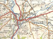
Tiverton-1946.jpg
Tiverton in 1946, before the A361 was diverted along the North Devon Link Road. This page contains scans from a map that is believed may be out of copyright according to UK Crown Copyright, UK Copyright Law for other maps published in the United Kingdom, or Irish Government Copyright, is not being used to generate profit in this context, and presents information that cannot be exhibited otherwise.
If the copyright holder considers this is an infringement of their rights, please contact the site management team to discuss further steps.
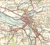
Barnstaple-1953.jpg
Barnstaple in 1953, before any of the bypasses were built! This page contains scans from a map that is believed may be out of copyright according to UK Crown Copyright, UK Copyright Law for other maps published in the United Kingdom, or Irish Government Copyright, is not being used to generate profit in this context, and presents information that cannot be exhibited otherwise.
If the copyright holder considers this is an infringement of their rights, please contact the site management team to discuss further steps.
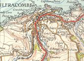
Ilfracombe-1953.jpg
Ilfracombe in 1953, showing the B3231 reaching the town! This page contains scans from a map that is believed may be out of copyright according to UK Crown Copyright, UK Copyright Law for other maps published in the United Kingdom, or Irish Government Copyright, is not being used to generate profit in this context, and presents information that cannot be exhibited otherwise.
If the copyright holder considers this is an infringement of their rights, please contact the site management team to discuss further steps.
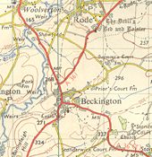
Beckington-1959.jpg
Beckington in 1959, showing the A36 and A361 multiplexing through the village before it was bypassed. This page contains scans from a map that is believed may be out of copyright according to UK Crown Copyright, UK Copyright Law for other maps published in the United Kingdom, or Irish Government Copyright, is not being used to generate profit in this context, and presents information that cannot be exhibited otherwise.
If the copyright holder considers this is an infringement of their rights, please contact the site management team to discuss further steps.
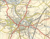
Frome-1959.jpg
Frome in 1959, showing the A361 and A362 passing through the town, and the B3098 before it was reclassified This page contains scans from a map that is believed may be out of copyright according to UK Crown Copyright, UK Copyright Law for other maps published in the United Kingdom, or Irish Government Copyright, is not being used to generate profit in this context, and presents information that cannot be exhibited otherwise.
If the copyright holder considers this is an infringement of their rights, please contact the site management team to discuss further steps.
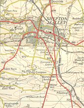
Shepton-1959.jpg
Shepton Mallet and Cannards Grave in 1959, with the A361 still passing through the town centre. This page contains scans from a map that is believed may be out of copyright according to UK Crown Copyright, UK Copyright Law for other maps published in the United Kingdom, or Irish Government Copyright, is not being used to generate profit in this context, and presents information that cannot be exhibited otherwise.
If the copyright holder considers this is an infringement of their rights, please contact the site management team to discuss further steps.
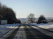
The A361 nearing Fulbrook - Geograph - 1650943.jpg
The A361 nearing Fulbrook
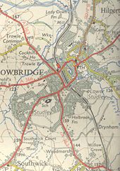
Trowbridge-1959.jpg
Trowbridge in 1959 This page contains scans from a map that is believed may be out of copyright according to UK Crown Copyright, UK Copyright Law for other maps published in the United Kingdom, or Irish Government Copyright, is not being used to generate profit in this context, and presents information that cannot be exhibited otherwise.
If the copyright holder considers this is an infringement of their rights, please contact the site management team to discuss further steps.
A361 Wiveliscombe - Coppermine - 15463.jpg
A361 Wiveliscombe

Wiveliscombe A361 sign 1969

Originally uploaded to Coppermine on Oct 04, 2007 by AAndy
East Lyng, from the west - Geograph - 1681381.jpg
East Lyng, from the west
Barnstaple Bypass - Coppermine - 3100.jpg
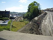
Barnstaple Bypass

The Barnstaple bypass under construction next to the railway station. Taken from the A3125 bridge.

Originally uploaded to Coppermine on Aug 21, 2005 by DavidBrown
Barnstaple bypass causeway - Coppermine - 3629.jpg
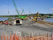
Barnstaple bypass causeway

A causeway to allow the bridge supports of the Barnstaple bypass to be built.

Originally uploaded to Coppermine on Sep 29, 2005 by DavidBrown
Barnstaple Downstream Bridge - Coppermine - 7718.jpg
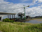
Barnstaple Downstream Bridge

We haven't had a bridge for a couple of months, so why not have one under construction, just for a change?! Taken from the north Bank of the Taw.

Originally uploaded to Coppermine on Sep 16, 2006 by DavidBrown
Barnstaple Bypass - Coppermine - 9280.jpg
Barnstaple Bypass

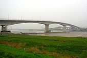
The Downstream Bridge in the mist.

Originally uploaded to Coppermine on Nov 21, 2006 by DavidBrown
Men at work - Coppermine - 10716.jpg
Men at work

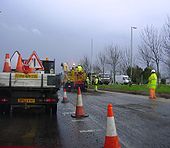
Resurfacing work on the A361 at Barnstaple. I don't think we've ever had a photo of people working before, so it might make a nice change...

Originally uploaded to Coppermine on Mar 19, 2007 by DavidBrown
Barnstaple Bypass - Coppermine - 12070.jpg
Barnstaple Bypass

Sorry to tread on David's toes here, but I'm submitting another photo of the Barnstaple Downstream Bridge; taken from the other side of the Taw.

Originally uploaded to Coppermine on May 23, 2007 by RichieGraham
Barnstaple Downstream Bridge - Coppermine - 12054.jpg
Barnstaple Downstream Bridge

As it opens tomorrow, I'd thought I would nominate this photo of the bridge.

Originally uploaded to Coppermine on May 22, 2007 by DavidBrown
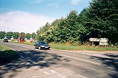
Side Road - Coppermine - 15284.jpg
Side Road

I could make this into a WAI, but I won't... it's a side road shortly before Moortown Cross on the A361, and also a ('successful') place where police cars hide...

Originally uploaded to Coppermine on Sep 17, 2007 by RichieGraham
North Devon Link Road - Coppermine - 15614.jpg
North Devon Link Road

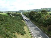
Taken from the Ash Mill flyover looking east.

Originally uploaded to Coppermine on Oct 22, 2007 by DavidBrown
A361 Barnstaple Bypass - Coppermine - 17823.jpg
A361 Barnstaple Bypass Originally uploaded to Coppermine on Apr 19, 2008 by Halstead
A361 Barnstaple bound - Coppermine - 18078.jpg
A361 Barnstaple bound

Taken on 12/04/08

Originally uploaded to Coppermine on May 19, 2008 by Halstead
A361 NDLR - Coppermine - 21670.jpg
A361 NDLR

Looking out towards Moortown Cross last autumn.

Originally uploaded to Coppermine on Mar 18, 2009 by DavidBrown
Snowy Mullacott - Coppermine - 23517.png
Snowy Mullacott

Whilst my winning effort last month is of a glorious summer's day, we do have to remember that this will be for December. And whilst the chances are that we won't have a white christmas (again), here's my effort to at least make it so on SABRE.

Originally uploaded to Coppermine on Nov 16, 2009 by DavidBrown
Mullacott Cross on the A361 - Geograph - 788784.jpg
Mullacott Cross on the A361
Twitchen Cross on the A361 facing North - Geograph - 788793.jpg
Twitchen Cross on the A361 facing North
Entering Braunton on the A361 - Geograph - 807475.jpg
Entering Braunton on the A361
The Apple Tree near Steanbow - Geograph - 1705891.jpg
The Apple Tree near Steanbow
A361 - Coppermine - 14996.jpg
A361

old Primary route sign on the A361 between Devizes and Avebury

Originally uploaded to Coppermine on Aug 26, 2007 by Ben04uk
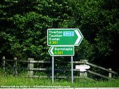
Incorrect Sign - Coppermine - 6675.jpg
Incorrect Sign

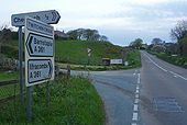
Location: Newtown Service Station, A361 / B3227. This sign is wrong for two reasons: Firstly, the sign is located on the B3227 and while the Barnstaple road is close, the road south is about a mile and a half away. Secondly, the top sign seems to imply that Tiverton and Taunton are reached using the M5, while Exeter can be reached by staying on the A361.

Originally uploaded to Coppermine on Jul 06, 2006 by RichieGraham
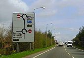
Incorrect direction sign - Coppermine - 5582.JPG
Incorrect direction sign

A sign on the A396 in Tiverton,Devon, which still shows the A361 NDLR as the A373. This ceased to be the case in 1988 when the rest of the NDLR was opened. Also note the unusual roundabout diagram at the top - this is because it is a teardrop roundabout.

Originally uploaded to Coppermine on Apr 21, 2006 by DavidBrown
Wykham cross roads - Geograph - 150831.jpg
Wykham cross roads
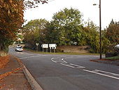
Crossroads on A361 - Geograph - 53637.jpg
Crossroads on A361
A39 Hazard Posts 2 - Coppermine - 9569.jpg
A39 Hazard Posts 2

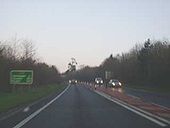
This picture taken part way through the 'offending' section shows that since the previous picture (taken on a bridge just behind), the posts have changed from being the red/white ones to being orange ones. A 'Queues Likely' sign can be seen mounted on the bridge, giving one wonder over what may happen during these likely queues and emergency vehicles...

Originally uploaded to Coppermine on Dec 20, 2006 by RichieGraham
A39 Hazard Posts 3 - Coppermine - 9568.jpg
A39 Hazard Posts 3

This shows the beginning of the section, where the double-whites marking the edge change to the dashed with hazard posts. Originally uploaded to Coppermine on Dec 20, 2006 by RichieGraham

Since this photo was taken the bollards have been removed and the route was renumbered A361 with the opening of the Barnstaple Western Bypass
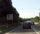
Coming into Shipton Under Wychwood - Geograph - 1578677.jpg
Coming into Shipton Under Wychwood
Sharp bend in the A361 - Geograph - 1564576.jpg
Sharp bend in the A361
Downhill on the A361 - Geograph - 1591580.jpg
Downhill on the A361
Zebra crossing on the A361 - Geograph - 1511697.jpg
Zebra crossing on the A361
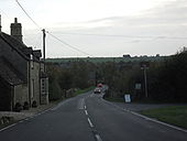
A361 approaching Fulbrook - Geograph - 1467867.jpg
A361 approaching Fulbrook
 
 
Page 1, 48 file(s) of 117 shown
Page 1 2 3

SABRE - The Society for All British and Irish Road Enthusiasts
Discuss - Digest - Discover - Help