Gallery:A3 (Northern Ireland)

From Roader's Digest: The SABRE Wiki
Jump to navigation Jump to search
A1-A99 (Northern Ireland) > A3 (Northern Ireland)


This gallery has no child categories
A3 (Northern Ireland)
 
 
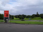
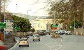
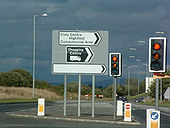
A3 Commercial 1 - Northern Ireland - Coppermine - 367.jpg
A3 Commercial 1 - Northern Ireland

Photo taken on A3 Northway in central Craigavon. This junction with an unclassified road was 'improved' and signalised over a year ago. The scheme was developer funded; though the intended development has since been dropped (hence the blank section of sign). The spelling mistake has yet to be corrected!

OP ShaunA303

Originally uploaded to Coppermine on Apr 06, 2005 by M4Simon
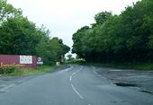
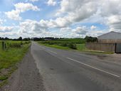
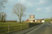
A3 N54 border - Coppermine - 13776.jpg
A3 N54 border

The speed limits ahead have 100 km/h on one side and NSL (60 mph) on the other side.

Originally uploaded to Coppermine on Jul 08, 2007 by Located
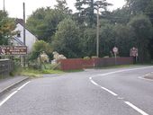
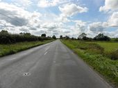
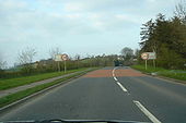
N54-A3 - Coppermine - 13771.jpg
N54-A3

Just before crossing into Northern Ireland from the Republic. This road is undergoing a rebuild. on both sides. See A3 photos in 'Other NI Roads' Album

Originally uploaded to Coppermine on Jul 08, 2007 by Located
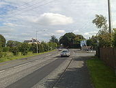
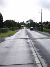
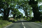
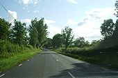
A3 between Magheralin and Moira - Geograph - 133199.jpg
A3 between Magheralin and Moira
Looking towards Moira going north.
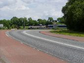
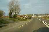
Belfast Road, Ballymacateer - Geograph - 1389628.jpg
Belfast Road, Ballymacateer
This is the A3 Belfast Road - in the short semi-rural patch that separates Lurgan and Dollingstown - in the townland of Ballymacateer. The B2 Dromore Road junction can be seen on the right. The view is towards Dollingstown village.
Central Roundabout, Craigavon - Geograph - 1415824.jpg
Central Roundabout, Craigavon
The largest roundabout in Craigavon by far - where the A3 Lake Road splits into Central Way and Mandeville Road. Rushmere (known locally still as the Craigavon Shopping Centre) sits behind the camera.
A33(NI).JPG
Old Barts map showing the A33 and the old route of the A34 This page contains scans from a map that is believed may be out of copyright according to UK Crown Copyright, UK Copyright Law for other maps published in the United Kingdom, or Irish Government Copyright, is not being used to generate profit in this context, and presents information that cannot be exhibited otherwise.
If the copyright holder considers this is an infringement of their rights, please contact the site management team to discuss further steps.
The A3 on the Fermanagh-Cavan Border - Geograph - 2490425.jpg
The A3 on the Fermanagh-Cavan Border
Entering County Monaghan - Geograph - 537263.jpg
Entering County Monaghan
The Dobbin Road - Geograph - 535098.jpg
Vicarage Road, former NI A3, south of Portadown (described as Dobbin Road on Geograph)
The main Portadown to Armagh Road - Geograph - 1353753.jpg
A3 Portadown to Armagh Road
A3, Cavan Road - Geograph - 2034449.jpg
A3, Cavan Road
Cavan Road, Clongowna - Geograph - 2034453.jpg
Cavan Road, Clongowna
Hull's Hill, Lisburn - Geograph - 2574113.jpg
Hull's Hill, Lisburn
The Hillsborough Road, Lisburn - Geograph - 1108140.jpg
The Hillsborough Road, Lisburn
A3 border in Co. Monaghan looking into Co. Armagh - Coppermine - 21285.jpg
N12/A3 border in Co. Monaghan looking into Co. Armagh Originally uploaded to Coppermine on Jan 25, 2009 by cormthechippy
A3 N54 border - Coppermine - 13774.JPG
A3 N54 border

Just crossing the Border again. The trees seem to be right on it. This is the last crossing before Cavan. You can see the km/h speed limit warning sign for the Republic.

Originally uploaded to Coppermine on Jul 07, 2007 by Located
Border with the N12 and A13 - Coppermine - 21284.jpg
Border with the N12 and A13 Originally uploaded to Coppermine on Jan 25, 2009 by cormthechippy
A13 entering Middletown, Co. Armagh - Coppermine - 21283.jpg
A3 entering Middletown, Co. Armagh Originally uploaded to Coppermine on Jan 25, 2009 by cormthechippy
A3 (N54) - Coppermine - 13772.JPG
A3 (N54)

The A3 on one of the exclaves of the Republic and Northern Ireland along this road.

Originally uploaded to Coppermine on Jul 07, 2007 by Located
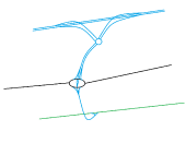
M12 (NI) current layout.png
M12 motorway Northern Ireland
M12 (NI) suggested new layout.png
M12 new layout (suggested changes)
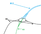
M12 Carn roundabout.png
M12 Carn roundabout
The Northway, Portadown (1) - Geograph - 1597583.jpg
The Northway, Portadown (1) This is the view towards the centre of Portadown from the Brownstown Road flyover.
Shillington Bridge plaque, Portadown - Geograph - 2679982.jpg
Shillington Bridge plaque, Portadown Doubtless unnoticed by all and sundry, this plaque, marking the opening of the Shillington Bridge, is under the Northway at Castle Street.
The Northway, Portadown (6) - Geograph - 2679904.jpg
The Northway, Portadown (6) The elevated section of the Northway (known as the Shillington Bridge) approaching Castle Street (foreground) after crossing the River Bann (behind the silver car towards the lower right). The construction of this road required the demolition of the former Ulster Railway station in Watson Street.
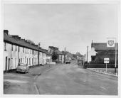
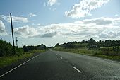
Main Street, Magheralin - Flickr - 50959134096.jpg
A3 Main Street, Magheralin, Co. Armagh.

Moira Rural District Council

Date: 12th January 1961

Reference: D4069/17/5

For queries in relation to reproducing this image, please contact PRONI (proni@communities-ni.gov.uk) citing the relevant catalogue reference number.
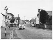
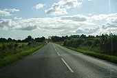
Main Street, Magheralin - Flickr - 50959133951.jpg
Description:

Main Street, Magheralin, Co. Armagh. Moira Rural District Council

Date: 12th January 1961

Reference: D4069/17/1

For queries in relation to reproducing this image, please contact PRONI (proni@communities-ni.gov.uk) citing the relevant catalogue reference number.
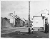
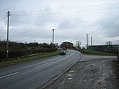
Magheralin, Co. Armagh. - Flickr - 50958431688.jpg
Description:

Street junction, Magheralin, Co. Armagh. Moira Rural District Council

Date: 12th January 1961

Reference: D4069/17/2

For queries in relation to reproducing this image, please contact PRONI (proni@communities-ni.gov.uk) citing the relevant catalogue reference number.
 

SABRE - The Society for All British and Irish Road Enthusiasts
Discuss - Digest - Discover - Help