Gallery:Cumberland Gap
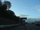
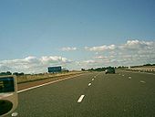
I'm a little surprised that the new VMS upgrades on this section are not MS4's.
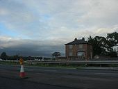
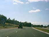
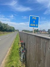
Originally uploaded to Coppermine on Oct 28, 2008 by MatthewAppears to be a boarded up house under compulsory purchase for the upgrade works. Not expecting that to be there much longer.
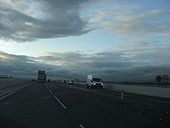
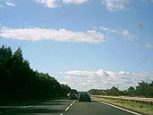
Originally uploaded to Coppermine on Oct 28, 2008 by MatthewI believe the two petrol stations will remain in place after the upgrade
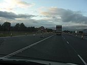
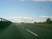
Originally uploaded to Coppermine on Oct 28, 2008 by MatthewCrossing over the new bridge
Originally uploaded to Coppermine on Oct 28, 2008 by MatthewHere is the Cumberland Gap as it was in 1965. There is no M6, no D2 road, just S2. It would be another 10 years before Gretna Green would be by-passed, 6 before the M6 comes to the A74. It would also be about 45 years before this section of road becomes motorway.
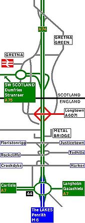
Originally uploaded to Coppermine on Nov 15, 2005 by ABeatonIn this strip map, the Dual Carrageway is yet to reach the A6071. Otherwsise the same as it was 1965.
Originally uploaded to Coppermine on Nov 15, 2005 by ABeatonHere is the A74 as it was in 2007.
Originally uploaded to Coppermine on Oct 04, 2005 by ABeatonHere is the A74 after the D3M started. This section was rebuilt in the early 1990's as part of the first phase of the A74 Upgrade. Once the HA finally start on the cumberland gap & it completion sometime in 2008/10, this section would have been waiting for the motorway to come to it section for 17-19 years. The Leech Line upgrade isn't as bad as it has taken the same time to upgrade 450 miles of railway & the Cumberland gap is only 6 miles. As Pathetic as the A6144(M)
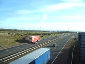
Originally uploaded to Coppermine on Sep 20, 2005 by ABeatonThe reason why the A74 was upgraded or in this case will be upgraded. Small slip roads to at small GSJ's for local Traffic. The new M6 will have no Juctions with all these small Villages & Hamlets & will be D3M all the way to the Scotish Border.
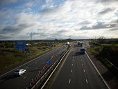
Originally uploaded to Coppermine on Sep 20, 2005 by ABeatonAfter 232 miles of Motorway (27 Tolled if you used the M6 Toll) you arrive at the A74 Cumberland Gap. The last bit to be upgraded as it is in England. As you can see from the Picture, it is very busy. Can the HA hurry up & finish off the motorway upgrade please. Oh also make sure you don't copy the near by WCML (Leech Line) & over spend by Billions.
Originally uploaded to Coppermine on Sep 20, 2005 by ABeatonHere is a important bridge. Due to be repalced in 2008 when the Cumberland Gap is closed, This carries the A74 over the WCML (Leech Line). The New Bridge will Carry the M6 & the extended B7076 over the Leech Line.
Originally uploaded to Coppermine on Sep 20, 2005 by ABeatonHere is the WCML (Leech Line) Bridge over the River Solway going towards the Solway Firth. Why the WCML is worth �10bn is anyones guess. The A74 is also going over the Solway River.
Originally uploaded to Coppermine on Sep 19, 2005 by ABeatonThe A74 has always started here. In pre M6 days, it was at grade with the A7 (the worst single figure A road on the British mainland. It doesn't have a motorway sister & worse no parrallell railway.) Now it starts once traffic from Carlisle meets the M6. By 2010, all this would have gone & been replaced with M6. J44 itself doesn't need any work. It already D3M so once the the works are completed, it would have been futureproofed for 31 years. Yikes! This marks the start of the Cumberland Gap, a naff D2 road.
Originally uploaded to Coppermine on Sep 19, 2005 by ABeatonThe A74 is dead. RIP 1923-2008. It now known as the M6. The M6 is bigger, longer & just as busy as ever. The Cumberland Gap has closed and the B7076 has been extended to the A7 thus taking over the last section of the A74, the Scottish section being renumbered A721. The Scottish Motorway Network (West) is now connected at last to the English Motorway network thus the British Motorway network is whole at last 52 years after the M6 first opened by-passing Preston.
Originally uploaded to Coppermine on Jun 17, 2005 by ABeatonThe only major change to the A74 at this end of the road is the upgrade of Gretna local Services to full MSA. The Bridges are built as D3M ready for the upgraded road.
Originally uploaded to Coppermine on May 21, 2005 by ABeatonThe first phase of the A74 upgrade has begun on the Gretna Green By-Pass. Work has also begun to GSJ the A75 & the Gretna roundabout to a half diamond.
Originally uploaded to Coppermine on May 21, 2005 by ABeatonThe slow death of the A74 has begun. The A74(M) is now built over the old Gretna Green By-Pass. It is D3M.
Originally uploaded to Coppermine on May 21, 2005 by ABeatonHere is the A74 as it was in 1969. M6 J44 is yet to be built so the original T-Junction is in use. the roundabout is being built though.
Originally uploaded to Coppermine on May 16, 2005 by ABeatonHere is the A74 before the M6 opened. Traffic is now using the roundabout that will become M6 J44
Originally uploaded to Coppermine on May 16, 2005 by ABeatonThis strip map of the A74 is based in 1971. The Cumberland Gap was S2. Gretna was yet to be by-passed. The M6 has just opened. This means Carlisle has been by-passed & the South of England & the A66 is easier to reach now.
Originally uploaded to Coppermine on May 16, 2005 by ABeatonMuch of the Cumberland Section of the A74 is now Dual. This allows M6 traffic to adjust to a A class road again.
Originally uploaded to Coppermine on May 16, 2005 by ABeatonHere is the A74 as it was in 1975. The English Section of the A74 is now Dualled up to the border. The Gretna Green By-Pass is under conturction. as is the link road to the then current A74.
Originally uploaded to Coppermine on May 16, 2005 by ABeatonHere is the A74 in the Glory years of 1976-85. This is the first section, M6-Gretna Green North.
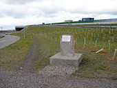
Originally uploaded to Coppermine on May 12, 2005 by ABeatonLooking south at the first 400m of the A74(M)beyond that it is still the A74. This section will be upgraded to full motorway standards by the end of 2008
