Gallery:M3 (Northern Ireland)
From Roader's Digest: The SABRE Wiki
Jump to navigation
Jump to search
Motorways in Northern Ireland > M3 (Northern Ireland)
This gallery has no child categories
M3 (Northern Ireland)
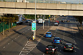
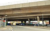
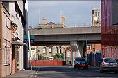
Middlepath Street, Belfast (2)
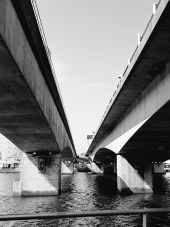
See J3574 : Middlepath Street, Belfast. The view from the Station Street/Bridge End flyover J3474 : The Station Street/Bridge End flyover, Belfast. The road on the left leads to the M3 J3474 : The Lagan Bridge, Belfast. The bridge (top) carries the railway to Londonderry and Larne Harbour J3474 : Elevated railway and road, Belfast.
See J3574 : Middlepath Street, Belfast. The view from the Station Street/Bridge End flyover J3474 : The Station Street/Bridge End flyover, Belfast. The road on the left leads to the M3 J3474 : The Lagan Bridge, Belfast. The bridge (top) carries the railway to Londonderry and Larne Harbour J3474 : Elevated railway and road, Belfast.
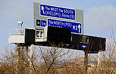
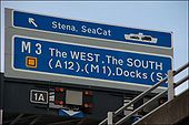
Motorway sign, Belfast (3)
See <a href='http://www.geograph.org.uk/photo/1464810'>J3474 : Motorway sign, Belfast (2)</a>. Gantry sign, on the M3 (westbound), for traffic heading from the Sydenham bypass towards the Westlink and the M2.
See <a href='http://www.geograph.org.uk/photo/1464810'>J3474 : Motorway sign, Belfast (2)</a>. Gantry sign, on the M3 (westbound), for traffic heading from the Sydenham bypass towards the Westlink and the M2.
Corporation Street, Belfast (3)
See <a href='http://www.geograph.org.uk/photo/590317'>J3474 : Corporation Street, Belfast (2)</a>. Corporation Street remains closed during the rebuilding of the Belfast sewers. An eerie calm prevails over what was once a street busy with traffic. In the ten minutes I spent here, one pedestrian and four vehicles passed (one had taken the wrong turning). The view is towards Corporation Square at the cross-harbour railway and road <a href='http://www.geograph.org.uk/photo/4750'>J3474 : Belfast Cross Harbour Links</a>.
See <a href='http://www.geograph.org.uk/photo/590317'>J3474 : Corporation Street, Belfast (2)</a>. Corporation Street remains closed during the rebuilding of the Belfast sewers. An eerie calm prevails over what was once a street busy with traffic. In the ten minutes I spent here, one pedestrian and four vehicles passed (one had taken the wrong turning). The view is towards Corporation Square at the cross-harbour railway and road <a href='http://www.geograph.org.uk/photo/4750'>J3474 : Belfast Cross Harbour Links</a>.
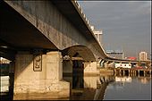
Elevated road and railway, Belfast (3)
See <a href='http://www.geograph.org.uk/photo/564453'>J3474 : Elevated road and railway, Belfast (2)</a>. The bridges as they cross the Lagan at Queen�s Quay. The railway bridge is almost hidden on the left. See also <a href='http://www.geograph.org.uk/photo/999230'>J3474 : The River Lagan, Belfast (1990) (2)</a>.
See <a href='http://www.geograph.org.uk/photo/564453'>J3474 : Elevated road and railway, Belfast (2)</a>. The bridges as they cross the Lagan at Queen�s Quay. The railway bridge is almost hidden on the left. See also <a href='http://www.geograph.org.uk/photo/999230'>J3474 : The River Lagan, Belfast (1990) (2)</a>.
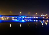
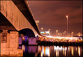
Lagan Bridges
The rail and road bridges over the River Lagan at night. See <a href='http://www.geograph.org.uk/photo/4750'>J3474 : Belfast Cross Harbour Links</a> for something similar during the day. This is the view looking towards the mouth of the Lagan.
The rail and road bridges over the River Lagan at night. See <a href='http://www.geograph.org.uk/photo/4750'>J3474 : Belfast Cross Harbour Links</a> for something similar during the day. This is the view looking towards the mouth of the Lagan.
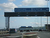
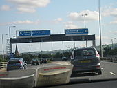
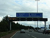
Motorway sign, Belfast (2)
See <a href='http://www.geograph.org.uk/photo/495862'>J3474 : Motorway sign, Belfast</a>. The same sign (amended to take account of the new terminals for the Stranraer and Isle of Man ferries) with the overhead lights showing a 40mph speed limit and lane closure due to roadworks. Continue to <a href='http://www.geograph.org.uk/photo/1760656'>J3574 : Motorway sign, Belfast (3)</a>.
See <a href='http://www.geograph.org.uk/photo/495862'>J3474 : Motorway sign, Belfast</a>. The same sign (amended to take account of the new terminals for the Stranraer and Isle of Man ferries) with the overhead lights showing a 40mph speed limit and lane closure due to roadworks. Continue to <a href='http://www.geograph.org.uk/photo/1760656'>J3574 : Motorway sign, Belfast (3)</a>.
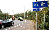
M3 sliproad, Belfast (3)
See <a href='http://www.geograph.org.uk/photo/1519660'>J3474 : M3 sliproad, Belfast (2)</a>. The on-slip to the M3 at Middlepath Street.
See <a href='http://www.geograph.org.uk/photo/1519660'>J3474 : M3 sliproad, Belfast (2)</a>. The on-slip to the M3 at Middlepath Street.
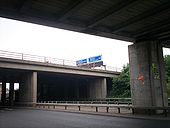
Motorway sign, Belfast
It is not easy to photograph a motorway sign legally. This was taken from ground level <a href='http://www.geograph.org.uk/photo/495849'>J3474 : Elevated railway and road, Belfast</a>. See also <a href='http://www.geograph.org.uk/photo/1464810'>J3474 : Motorway sign, Belfast (2)</a>.
It is not easy to photograph a motorway sign legally. This was taken from ground level <a href='http://www.geograph.org.uk/photo/495849'>J3474 : Elevated railway and road, Belfast</a>. See also <a href='http://www.geograph.org.uk/photo/1464810'>J3474 : Motorway sign, Belfast (2)</a>.
Elevated road and railway, Belfast (2)
See <a href='http://www.geograph.org.uk/photo/495849'>J3474 : Elevated railway and road, Belfast</a>. This is a view of the bridges as they pass Tomb Street. The railway is nearest the camera. The Harbour Office is in the background.
See <a href='http://www.geograph.org.uk/photo/495849'>J3474 : Elevated railway and road, Belfast</a>. This is a view of the bridges as they pass Tomb Street. The railway is nearest the camera. The Harbour Office is in the background.
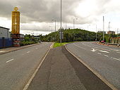
M3 Offslip - Sydenham Bypass Onslip, Belfast
To the left is the onslip to the A2 Sydenham Bypass (opened 1938) and to the right is the offslip from the M3 Harbour Bridge (opened 1995) to Sydenham Road and the Odyssey complex. Both are closed off at the time of being photographed due to the 2009 Tall Ships Festival.
To the left is the onslip to the A2 Sydenham Bypass (opened 1938) and to the right is the offslip from the M3 Harbour Bridge (opened 1995) to Sydenham Road and the Odyssey complex. Both are closed off at the time of being photographed due to the 2009 Tall Ships Festival.
M2 foreshore section
Approaching the end of the M2, the VMS warns of delays on the A12 Westlink. Photo taken 06.08.2007.
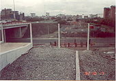
Originally uploaded to Coppermine on Aug 07, 2007 by csdM2/M3 junction 1992
Looking south from Yorkgate railway station, Belfast, across Dock Street. On the left is the M2 terminus at York Street with the 'ski jump' in place for the M3. Neither the M3 nor the cross-harbour railway has been built here. The M3 opened in 1995.
Originally uploaded to Coppermine on Apr 30, 2007 by nirsDock Road, Belfast
This is dock road in Belfast. The road itself is D2 while above me is the junction of the NI M2 & M3. This is not far from the A12 Westlink road.
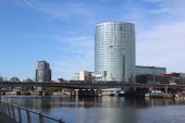
Originally uploaded to Coppermine on Jun 24, 2007 by ABeatonBelfast's Dargan Bridge (railway) to the left and Lagan Bridge (M3 motorway) to the right, crossing the River Lagan.
