Star.pngStar grey.pngStar grey.pngStar grey.pngStar grey.png

H5 (Milton Keynes)

From Roader's Digest: The SABRE Wiki
Jump to navigation Jump to search
H5
Location Map ( geo)
Cameraicon.png View gallery (1)
Portway
From:  Oakhill (SP815362)
To:  Northfield Roundabout (SP891408)
Distance:  5.7 miles (9.2 km)
Meets:  V2, V3, V4, A5, V6, V7, V8 / B4034, V9, V10, V11, H6 / A4146, A5130
Highway Authorities

Milton Keynes

Traditional Counties

Buckinghamshire

Route outline (key)
H5 Oakhill - Northfield Roundabout

The H5 Portway is a Milton Keynes grid road. West of the A5, it is the C145, while east of the A5 it forms part of the A509.

Named Junctions

Image Name Classified Road(s) Grid Reference More Info Map
Photo-required.png Oakhill Roundabout V2 SP817363
SABRE • Google • geo
Photo-required.png Melbourne Roundabout V3 SP822366
SABRE • Google • geo
Photo-required.png Loughton Roundabout V4 SP828375
SABRE • Google • geo
Photo-required.png Portway Roundabout A5 SP836383 H5 east of here is also A509
SABRE • Google • geo
Photo-required.png North Grafton Roundabout V6 SP841386
SABRE • Google • geo
Photo-required.png North Witan Roundabout SP845389
SABRE • Google • geo
Photo-required.png North Saxon Roundabout V7 SP848391
SABRE • Google • geo
Photo-required.png North Secklow Roundabout SP852394
SABRE • Google • geo
Photo-required.png Belveredere Roundabout B4034 / V8 SP856397
SABRE • Google • geo
Photo-required.png North Skeldon Roundabout SP860399
SABRE • Google • geo
Photo-required.png North Overgate Roundabout V9 SP865401
SABRE • Google • geo
Photo-required.png Pagoda Roundabout V10 SP873403
SABRE • Google • geo
Photo-required.png Pineham Roundabout V11 SP883403
SABRE • Google • geo
Photo-required.png Northfield Roundabout A509 • A4146 / H6 • A5130 SP890403
SABRE • Google • geo

An image has been requested for this article.


H5 (Milton Keynes)
Junctions
Related Pictures
View gallery (1)
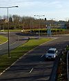
Milton Keynes roundabout - Geograph - 1208064.jpg
Milton Keynes Council Roads
A and B RoadsA421 • A422 • A428 • A509 • A4146 • B526 • B565 • B4034 • B5388
C RoadsC5 • C6 • C7 • C9 • C10 • C13 • C14 • C17 • C20 • C24 • C25 • C26 • C27 • C28 • C34 • C41 • C42 • C43 • C48 • C53 • C54 • C83 • C127 • C129 • C130 • C131 • C132 • C139
C140 • C141 • C142 • C143 • C144 • C145 • C146 • C147 • C149 • C150 • C151 • C152 • C154 • C155 • C156 • C157 • C158 • C159 • C160 • C162 • C174 • C179 • C181
H Grid RoadsH1 Ridgeway • H2 Millers Way • H3 Monks Way • H4 Dansteed Way • H5 Portway • H6 Childs Way • H7 Chaffron Way • H8 Standing Way • H9 Groveway • H10 Bletcham Way
V Grid RoadsV1 Shelshall Street • V2 Tattenhoe Street • V3 Fulmer Street • V4 Watling Street • V5 Great Monks Street • V6 Grafton Street • V7 Saxon Street • V8 Marlborough Street • V9 Overstreet • V10 Brickhill Street • V11 Tongwell Street • V12 Fen Street


SABRE - The Society for All British and Irish Road Enthusiasts
Discuss - Digest - Discover - Help