Hereford
| Hereford | |||
| Location Map ( geo) | |||
| |||
| County | |||
| Herefordshire | |||
| Highway Authority | |||
| Herefordshire | |||
| Forward Destination on | |||
| A49, A438, A465, A4103 | |||
| Next Primary Destinations | |||
| Abergavenny • Brecon • Gloucester • Leominster • Ross-on-Wye • Worcester | |||
| Places related to the A49 | |||
Ross-on-Wye • Leominster • Warrington • Wigan • Shrewsbury • Whitchurch • Preston • Ludlow • Ashton-in-Makerfield • Newton-le-Willows | |||
| Places related to the A465 | |||
| Places related to the A438 | |||
Hereford is a Primary Destination and city in Herefordshire. It is notorious for being one of the cities in the UK without an official bypass, however there are two unofficial ones on the northern and eastern sides. The lack of a proper bypass and the A49, A438 and A465 all meeting near the city centre results in considerable traffic jams, both in and out of rush hour.
History
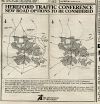
Hereford Inner Relief Road Stage 1: Greyfriars Bridge was completed in October 1966 but the official opening was delayed to allow refacing after vandals poured black paint over the white side facings of the bridge. The official opening was on 19 January 1967 by Peter Carter, Mayor. It was a prestressed concrete bridge with a 200 foot span. The dual carriageway section of the North-South Relief Road was from St Nicholas Street to Belmont Roundabout (A465) Contractor was Cementation Construction Ltd.
The last section on the A49 North-South Relief Road from St Nicholas Street to Edgar Street was to be opened to two way traffic on 12 October 1969. The last section of the A465 East-West Relief Road, (possibly Newmarket street) was due to open two weeks later. The official opening was on 11 December 1969 by David Gibson-Watt, MP for Hereford. Cost £324,000. Both were dual carriageway upgrades to existing roads.
On 18th December 2017 the City Link Road opened. This road runs from the A49 on Edgar Street to the bottom of Aylestone Hill by the railway station and has been classified as the A465. Commercial Road was renumbered to A4193 at the same time.
A Southern Link Road between the A49/B4399 roundabout and the A465/B4349 junction is also being planned. Its number hasn't been confirmed yet but it looks likely that it will be an extension of the B4399.
Routes
Several routes radiate from Hereford.
| Route | To | Notes |
| Leominster | ||
| Ross-on-Wye | ||
| Brecon, Kington, (A4111) | Access to Brecon is via A470 | |
| Tewkesbury, Ledbury | ||
| Abergavenny | ||
| Worcester | ||
| city centre | The new number for Commercial Road when the A465 is diverted along the City Link Road | |
| Bromyard | ||
| Monmouth | ||
| Credenhill | ||
| Kington | ||
| Fownhope | ||
| Clehonger |


