Star.pngStar grey.pngStar grey.pngStar grey.pngStar grey.png

Holyhead Road

From Roader's Digest: The SABRE Wiki
Jump to navigation Jump to search
Holyhead Road
Location Map ( geo)
Cameraicon.png View gallery (7)
From:  London (TQ321813)
To:  Holyhead (SH246820)
Via:  Wolverhampton
Old route now:  A1, A1000, A1081, B556, M25, A1081, A5, A5183, A5, V4, A5, A45, B4038, A4256, A45, B4429, A45, B4110, A4082, A4114, A45, B4104, A45, B4128, B4100, A41, A4196, A41, A464, B5061, B4380, A5064, A458, B4380, A5, B5009, A5, B5070, A5, B4501, B5105, A5, A5154
Primary Destinations
Traditional Counties

Anglesey • Bedfordshire • Buckinghamshire • Caernarfonshire • Denbighshire • Hertfordshire • Merionethshire • Middlesex • Northamptonshire • Shropshire • Staffordshire • Warwickshire

Thomas Telford's Holyhead Road was an attempt to improve communications between London and Ireland. It is commonly supposed that the Holyhead Road followed the modern A5, but this was not the case, instead taking what is now A45, A41 and A464 so as to take in the major industrial cities of Coventry, Birmingham and Wolverhampton rather than the less populated A5 route.

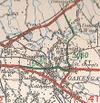


Holyhead Road
Junctions
Crossings
Places
Miscellaneous
Related Pictures
View gallery (7)
Oakengates-1922.jpgOakengates-1927.jpgA5 -Historic route - Coppermine - 3060.jpgThe Rock Cutting,Tettenhall, looking towards Newbridge - Geograph - 411044.jpgHistoric Road - Geograph - 861205.jpg
Other nearby roads
London
NCN1 • NCN20 • NCN21 • A1 • A1(M) • A1/Sandbox • A2 • A2(M) (Kidbrooke - Falconwood) • A3 • A4 • A5 • A10 • A11 • A11(M) • A12 • A13 • A20 • A21 • A23 • A23(M) Provisional Allocation • A24 • A30 • A30/Sandbox • A40 • A41 • A101 • A127 • A216 • A233 • B269 • B519 • Balham Loop • E1 (Old System) • E2 (Old System) • E5 (Old System) • E8 (Old System) • E13 • E15 • E30 • E31 (via Carlisle) • E31 (via Newcastle) • E33 (London - Glasgow) • E105 (London - Fishguard) • E107 (London - Tilbury) • E108 (London - Southend) • East Cross Route • Ermine Street • EuroVelo 2 • EuroVelo 5 • Great North Road • London Inner Ring Road • Longest Lane • M1 • M3 • M4 • M11 • M12 (Brentwood - Chelmsford) • M12 (Woodford - Brentwood) • M12 (Woodford - Maplin) • M13 • M14 • M15 • M16 • M20 • M23 • M25 • M30 • M40 • M41 • M100 • NCN13 • NCN4 • Northern and Western Motorway • Orbital Tunnel Route • Ringway 2 • Ringway 3 • Ringway 4 • RM3 • South Cross Route • T1 (Britain) • T2 (Britain) • T3 (Britain) • T4 (Britain) • T5 (Britain) • T6 (Britain) • T8 (Britain) • T9 (Britain) • T10 (Britain) • T11 (Britain) • T12 (Britain) • T31 (Britain) • T32 (Britain) • T33 (Britain) • T34 (Britain) • T35 (Britain) • Watling Street
Coventry
A45 • A46 • A423 • A427 • A428 • A429 • A444 • A445 • A4023 • A4053 • A4082 • A4114 • A4170 • A4273 • A4600 • B4027 (Warwickshire) • B4076 • B4082 (Coventry) • B4098 • B4101 • B4105 (Coventry) • B4106 • B4107 • B4107 (Coventry city centre) • B4108 • B4109 • B4110 • B4111 (Coventry - Kilworth) • B4113 • B4115 • B4118 (Coventry) • B4428 • B4454 (Coventry) • B4481 • B4544 • Coventry East-West Motorway • Coventry North-South Motorway • Droitwich - Leicester Motorway • E24 • E28 (Birmingham - Ipswich) • E33 (London - Glasgow) • E33 (Northampton - Liverpool) • M6 • M45 • M69 • Northern and Western Motorway • Sherbourne Valley Road • T11 (Britain) • T44 (Britain) • T114 (Britain)
Birmingham
A34 • A38 • A38(M) • A41 • A42 (Reading - Birmingham) • A45 • A47 • A435 • A441 • A452 • A453 • A455 (Birmingham - Stafford) • A456 • A457 • A458 • A4027 • A4028 • A4029 • A4030 • A4040 • A4097 • A4123 • A4166 • A4167 • A4400 • A4540 • A4723 • A5127 • B38 (Selly Oak) • B384 • B3800 • B4025 • B4043 • B4096 • B4100 (Birmingham) • B4114 • B4118 (Birmingham) • B4120 • B4121 • B4122 (Birmingham) • B4123 • B4124 • B4125 • B4126 • B4127 • B4128 • B4128 (Suffolk Street, Birmingham) • B4129 • B4129 (Birmingham City Centre) • B4130 • B4131 • B4132 • B4133 • B4134 • B4135 • B4136 • B4137 • B4140 • B4141 (Birmingham) • B4142 • B4143 (Birmingham) • B4144 • B4145 • B4146 • B4147 • B4148 • B4167 • B4182 • B4217 • B4284 • B4498 • B4514 • B4515 • B4516 • B4531 • B4532 • B4533 • B4552 • B4730 • E05 • E24 • E28 (Birmingham - Ipswich) • E33 (London - Glasgow) • E116 (Old System) • Longest Lane • M5 • M6 • M40 • M42 • M600 • Northern and Western Motorway • Ryknild Street • T13 (Britain) • T14 (Britain) • T15 (Britain) • T16 (Britain) • T35 (Britain) • T53 (Britain)
Wolverhampton
A41 • A446(M) • A449 • A454 • A457 • A459 • A460 • A462 • A463 • A464 • A464 (Oaken - Nantwich) • A4038 • A4039 • A4098 • A4123 • A4124 • A4126 • A4150 • A4444 • A4510 • B4155 • B4156 • B4157 • B4158 (Wolverhampton) • B4159 • B4160 (Wolverhampton) • B4161 • B4162 • B4162 (Monmore Green - Deepfields) • B4163 • B4164 (Moxley - Ocker Hill) • B4200 • B4454 (Wednesfield) • B4464 • B4483 • B4484 • B4563 • B4590 • Bilston Link Motorway • C6 (Staffordshire) • C17 (Dudley) • C19 (Dudley) • C20 (Dudley) • C40 (Staffordshire) • C59 (Staffordshire) • C60 (Staffordshire) • C77 (Staffordshire) • C78 (Staffordshire) • C84 (Staffordshire) • C99 (Staffordshire) • C108 (Staffordshire) • C114 (Staffordshire) • C116 (Staffordshire) • C125 (Staffordshire) • C131 (Staffordshire) • C137 (Staffordshire) • C153 (Staffordshire) • C169 (Staffordshire) • C170 (Staffordshire) • C184 (Staffordshire) • C198 (Staffordshire) • C227 (Staffordshire) • C234 (Staffordshire) • C235 (Staffordshire) • C253 (Staffordshire) • C259 (Staffordshire) • C260 (Staffordshire) • C272 (Staffordshire) • C273 (Staffordshire) • C307 (Staffordshire) • C335 (Staffordshire) • C342 (Staffordshire) • C500 (Staffordshire) • E33 (London - Glasgow) • E34 (Old System) • M6 • M6 Toll • M54 • NCN81 • Northern and Western Motorway • T11 (Britain) • T14 (Britain) • T49 (Britain) • T50 (Britain) • U99 (Wolverhampton) • U110 (Wolverhampton) • U111 (Wolverhampton) • U112 (Wolverhampton) • U113 (Wolverhampton) • U114 (Wolverhampton) • U115 (Wolverhampton) • U116 (Wolverhampton) • U117 (Wolverhampton) • U118 (Wolverhampton) • U119 (Wolverhampton) • U120 (Wolverhampton) • U121 (Wolverhampton) • Western Orbital • Wolverhampton Outer Ring Road
Holyhead
A5 • A55 • A5153 • A5154 • B4545 • E22 • E34 (Old System) • EuroVelo 2 • Ffordd Gogledd Cymru • NCN8 • T11 (Britain)

SABRE - The Society for All British and Irish Road Enthusiasts
Discuss - Digest - Discover - Help