Jersey
| Jersey Jèrri | |||||||||||||||
| Location Map ( geo) | |||||||||||||||
 | |||||||||||||||
| |||||||||||||||
| Signage colour | |||||||||||||||
| |||||||||||||||
| Units | |||||||||||||||
| |||||||||||||||
| General data | |||||||||||||||
| |||||||||||||||
Network
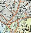
Jersey's road network consists of A Roads, B Roads and C Roads. While all classified roads are the responsibility of the Government of Jersey's infrastructure department, the Government also manages from non-classified routes, which have been given X prefixes, and include the X1 which leads into the main ferry port area and the X5 which accesses the power station and oil terminal.
The remainder of the public roads are managed by the relevant parish authority, however few have a dedicated highway maintance team. All 12 have a roads committee (Comité des Chemins), who make decisions about the parish highways among other duties, and two Inspecteurs du Chemin for each Vigntaine/Cuillette within the parishes (Aka Roads Inspectors). The result is that the small island has 13 active highway authorities. In addition, a number of primarily residential roads are owned and managed privately or by arms-length state bodies, such as the Ports of Jersey.
Green Lanes
Within the minor road network, all of the parishes except Trinity and St Saviour have classified some routes as Green Lanes. These are routes which are restricted to a 15 mph speed limit, and where motorised traffic should give way to cyclists and pedestrians. Whilst it would be nice in theory to ban motorised traffic completely, almost all of the green lanes have properties along them making such a move impossible.
Signage
States roads normally follow standard UK signage practice, although Jersey does not adhere to TSRGD. However, direction signs vary somewhat. Many do not use transport font, and the stroke widths are often somewhat smaller than in the UK, allowing the provision of smaller signs, which better suit the often narrow roads. Green and yellow signage is haphazardly used for 'main roads', which includes most A roads and some B roads. All other routes are signed with the black and white style.
Parish Roads are far less consistent in signage, with each parish having responsibility for their routes. This has led to a variety of solutions for problems that shouldn't really exist - sometimes the end of a speed limit is signed with a cross between the NSL and speed limit sign - such as a 30 with grey diagonal strikes showing that the 30 zone has ended. This is less used on new speed limits. However, when this is used for a 20, it is ambiguous as to whether it means NSL now applies, or the previous speed limit, which could well be 30, or even 15, depending on the route taken through the zone. Also, particularly at parish boundaries, signs can be completely absent.
Signage on Green Lanes also varies. There is a specific rectangular pictorial sign for Green Lanes, used with either 'Start of Green Lane' or 'End of Green Lane' legends underneath, although a strike through isn't always used. These should be used in conjunction with 15 roundels, however, it is very haphazard, whether due to signs being removed or never having been installed in the first place.
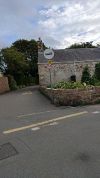
Another quirk on Jersey is that it is normal for any named road to carry a nameplate at every junction. However, there is no specification that these signs should be accurate, and there have been a number of complaints over the years regarding inaccurate translations between English and French / Jerraise, as well as concerns that some roads have been signed in a language other than the one in common usage, leading to confusion. Again, as each parish is individually responsible, it seems to be difficult to get a consistent approach across the island.
Numbering
Driving
Speed Limits
Jersey has a National Speed Limit of 40 mph, so the standard black strike on a white circle which on the UK mainland means 60 mph means 40 mph on Jersey. Within the urban areas the speed limit is normally reduced to 30 or 20 mph, although there are occasionally other recomended speeds on bends and so on. All speed limits are the responsibility of central goverment, even parish by-roads, although parishes are usually consulted before any changes.
In addition to the above, there is also a 15 mph limit on those routes designated Green Lanes, see above.
Other rules
The majority of other rules and signage on Jersey will be familiar to UK drivers. The following are some notable exceptions:
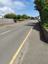
- Single yellow lines are the equivalent of double yellows on the mainland (although they can also be found in some short-stay loading bays and some no stopping zones). Unlike the UK, parking is not permitted for disabled drivers and you cannot stop on yellow lines to load/unload. There are no equivalents of UK red lines or single yellow lines.
- Verge lines are more infrequent along carriageway edges.
- The horizontal marking for "Give way" is a broad yellow stripe painted across the end of a lane at its junction with a major road.
- "Filter in turn" is a common instruction, with a number of junctions subject to this requirement, which is aimed at equalizing traffic flow. The vertical sign is a downward-pointing triangle with the words "Filter in turn" replacing "Give way".
- Belisha beacons are not always used at zebra crossings, especially newer ones in St Helier.
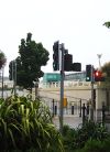
- Traffic lights at junctions omit the red+amber phase which is standard in the UK; however, pedestrian crossing lights follow UK practice in having a flashing-amber phase.
- There is a general view of "if in doubt, give way", resulting in much more courteous driving amongst locals, who will let traffic out of side roads, and pedestrians across roads away from crossings.
Junctions
Bridges, Tunnels, and other Crossings


