Michelin Mapping
| Michelin 1:200,000 | |||
 | |||
| |||
| Publisher: | Michelin | ||
| Scale: | 1:200,000 | ||
| SABRE Maps layer: | No | ||
1920s/30s sheets
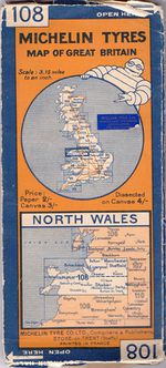
Michelin have been producing maps of the UK for many years, and back in the late 1920s / early 1930s they covered most of the mainland with a series of around 15 sheets at a scale of 3.15 miles to an inch, or 1:200,000. These were complemented by a 16 miles to the inch route planning map. The maps, as advertised via Amazon, are all listed as published in 1925, though the maps were actually updated over several years.
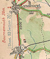
The maps were two panels tall and 10 wide, allowing the map to be opened from either side to see the north, or south side of the map. This was suggested with 'NORTH OPEN HERE' printed at the top, and 'SOUTH OPEN HERE' inverted at the bottom of both covers. Based on OS mapping, the maps were clearly designed for drivers, with 'Dangerous Point', 'Bad Bump or Gulley' and 'Gates' all clearly annotated, as well as three ranges for steep hills - 1:20-1:14; 1:14-1:10 and 1:10 and above. Roads were coloured based on standard, so Red for Main Through Routes, Yellow for Good Connecting Roads and white for Other Metalled Roads. However, all colours stop for Urban areas, even small villages. A and B road numbers are marked fairly comprehensively, although with the often rapid changes in road numbering that occurred between 1922 and 1935, it is difficult to be certain how comprehensive the maps are!
The original series of maps were numbered 102-115, omitting northern and western Scotland. They were subsequently renumbered as No1-15, albeit with different sheet numbers shown on the front panel, in the format S. xB for the 3 northernmost Scottish Sheets. Sheet No 2 also suggests that the western coast of Scotland was fully covered by two additional (vertical) sheets, although no numbers are shown. These later sheets have Bibendium holding a Cigar as he 'cuddles' the coverage area diagram.
The maps can be dated by the revision code in the top left hand corner of the maps, which consisted of two numbers separated by a dash. Within the codes, the first two digits show the year, followed by the size of the print run, whilst after the dash the first digit represents the edition number, and the last digit(s) display the month of printing.
These early maps were available on paper for 2/-, on canvas for 3/- or dissected on Canvas for 4/-.
| Map Number | Map Name | Overlaps | Revisions | Notes |
|---|---|---|---|---|
| 101 | Available as No.1 / S1B | |||
| 102 | Northern Highlands | also No.2 / S2B | ||
| 103 | Southern Highlands | also No.3 / S3B | ||
| 104 | The Lowlands | |||
| 105 | ||||
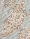
| 106 | The Lakes and Moors | Isle of Man inset under Cumbria | ||
| 107 | Mersey, Humber, The Peak District | Large Overlap around Manchester/Cheshire with Sheet 108 | ||
| 108 | North Wales | Large Overlap around Manchester/Cheshire with Sheet 107 | West end of Lleyn Peninsula in inset under Anglesey | |
| 109 | ?Mid Wales? | |||
| 110 | Fens & Broads | |||
| 111 | ?South Wales? | West Pembrokeshire on inset in SW corner of sheet | ||
| 112 | ?London North? | Overlaps with 114 | ||
| 113 | Westward Ho! | Overlaps with 111 and 115 | ||
| 114 | London South | Overlaps with 112 | ||
| 115 | English Riviera | Overlaps with 113 |
| Michelin Mapping | ||||||||
| ||||||||
|


