N15
| N15 | ||||
| Location Map ( geo) | ||||
 | ||||
| From: | Sligo (G691367) | |||
| To: | Lifford Bridge (border) (H334983) | |||
| Via: | Ballyshannon, Donegal, Ballybofey | |||
| Distance: | 111.1 km (69 miles) | |||
| Meets: | N4, N16, R291, R279, R267, R280, N3, R231, R232, N56, R252, N13, R235, N14, A38 | |||
| Primary Destinations | ||||
| Highway Authorities | ||||
| Traditional Counties | ||||
| Route outline (key) | ||||
| ||||
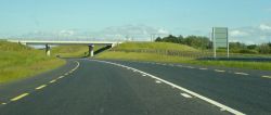
The N15 is a fantastic road in north-western Ireland, rejoicing in many recent upgrades, running north-eastward from Sligo town. Following the coast to start with, it crosses south-west County Donegal to reach the border with Northern Ireland at Lifford.
Route
Section 1: Sligo - Donegal
We start our journey in Sligo, with a traffic-light junction where three N roads terminate. The N4 heads South East to Dublin, the N16 heads east, to become the A4 on its way to Enniskillen, and our road, the N15 heads north. Almost immediately, the R291 turns off to the left, running out to Rosses Point.
We are heading almost due north, with the characteristic Irish 'slow lanes' on the outside which are used to allow overtaking. A large loop bypasses Tully Hill, and then the road turns north west to Drumcliff. Just north of the village, a maze of roads lead out along the headland, and if you are lucky you will find your way to Lissadell House, a rather splendid Georgian place. We then pass through several villages, the road occasionally narrowing, as we pick up the coast and turn northeastwards. At Cliffony the R279 heads north to Mullaghmore and its beaches.
Eleven kilometres later, we reach the Bundoran bypass, where the R267 takes the old route through the town. After crossing the R280, we stay on the new road until Ballyshannon is passed too. Just before crossing the River Erne, the N3 joins at a GSJ from Belleek to the east, and then the road strides across the river on the graceful bridge.
At the next roundabout, we meet the R231 which follows the coast, and return to the old alignment. However, long sections feature those 'slow lanes', so progress is normally good. At Ballintra the R231 rejoins, and we head for the coast ourselves, without ever quite reaching it. Much of this road appears to be a post-war new build, and maps / aerial photography back up this thought, but perhaps someone with local knowledge could clarify.
Six kilometres further north, we reach Laghy, where the R232 heads east to Pettigo and the border. Another kilometre north and the old route into Donegal turns left along the R267 at a roundabout junction. The N15 then sweeps across virgin countryside to the east of Donegal, meeting the N56 at another roundabout.
Section 2: Donegal - Lifford
After Donegal, the N15 continues north-eastward, but this heading is now carrying us inland, with the N56 taking up the coastal route. This part of the road is fairly straight, running through valleys up to Stranorlar, where it meets the N13 to the east of the town centre. The N15, meanwhile, heads along the north side of the River Finn, through Castlefinn, up to Lifford, where it meets the N14 at a roundabout. The last section of the road crosses the River Foyle on the Lifford Bridge to enter County Tyrone, and hence Northern Ireland, becoming the A38 for a short distance up to the A5.
History & Future
Much of the route has been realigned or bypassed since the early 1980s, including the pre-1995 bypass of the village of Ballintra; the 1999 Donegal Town bypass and the 2006 Ballyshannon-Bundoran bypass.
A 22km scheme to provide a new route from Sligo to beyond Cliffony was suspended in the late 2000s but is still eventually intended. This would have replaced the worst condition section of the road, and included a HQDC bypass of Sligo.
A bypass for Ballybofey and Stranorlar was refused planning permission in 2009 for safety concerns. A new proposed route corridor is being developed as of 2019.
It is planned to bypass Lifford to the South and provide a new bridge over the Foyle to link to the A5; but as the A5 has descended in to legal difficulties this has been postponed.
Improvement Projects


