N75
| N75 | |||
| Location Map ( geo) | |||
| |||
| From: | Twomileborris (S127586) | ||
| To: | Thurles (S199570) | ||
| Distance: | 7.6 km (4.7 miles) | ||
| Meets: | M8, N62 | ||
| Highway Authorities | |||
| Traditional Counties | |||
The N75 is a short but effective link road running from Junction 5 of the M8 at Twomileborris to the N62 in the town of Thurles in County Tipperary.
Route
The start of the route lies at the M8's Junction 5, a limited-access dumbbell junction which allows passage only between the N75 and the M8 to and from the north; however, there is plenty scope to built extra slip roads to facilitate access to and from the south. The first kilometre or so is a very modern S2, cutting across the farmland to the south of Twomileborris. To the west of the village, the road reconnects with its original route (see 'History' below) via a T-junction with a filter lane for turning traffic, and turns westwards.
From this point onwards, the N75 runs in an almost completely straight line towards Thurles, as an older-style S2 road which lacks the hard shoulders often found on such routes in Ireland. There are occasional frontages along its course, although it remains subject to a 100km/h speed limit. As the road enters the town it widens to accommodate stretches of parallel parking spaces along the roadside. The road crawls through the suburbs for some time before curving to the left and being interrupted by a roundabout which provides access to the residential areas adjacent to the route. The road passes an Aldi supermarket to the right as it draws close to the town centre. It also curves very subtly to the right after it passes the colourful Barretts Coachyard Inn, and then just as gently to the left as it approaches the heart of the town.
An unsigned tributary route joins the N75 at a mini-roundabout at the edge of the town centre, from which the N75 proceeds along Cathedral Street, right in front of the impressive cathedral. The Munster Hotel occupies a similarly spectacular building on the opposite side of the road. There is a pedestrian crossing controlled by traffic lights near the cathedral, and the road crosses the River Suir via a modern bridge offering a view upon the Aviary Pheasant Island. Immediately on the left as we cross the bridge is an ancient tower which looks like it would once have guarded the gateway to the town.
After that, the road widens considerably into Liberty Square, gradually dividing into two carriageways which permit parking in the central reservation. The 'square' widens progressively, forming a triangle, at the end of which it joins the one-way system that carries the N62 though the town. From here, you have various options. A left turn will take you onto the southbound N62, which leads back to the motorway. Heading straight on will take you onto the R661, which flirts with the Dublin-Cork railway line as far as Tipperary. A right turn will take you around the one-way system, giving you the choice of following the R498 towards Nenagh, or the northbound N62, towards Templemore and the Irish midlands. Whichever route you take, the N75 ends here.
History
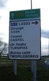
In its original incarnation, the N75 would have begun on the N8, the main road linking Ireland's capital Dublin with its second city, Cork. When the N8 became the M8, its course was altered and the old road was reclassified as the R639. The route of the N75 was adjusted accordingly, so that the route began at a brand new junction with the new motorway. The former course of the N75 through Twomileborris is now numbered L4202.
| N75 | ||||||||
| ||||||||
| ||||||||
| ||||||||
| ||||||||
|


