OS Explorer/Sheets 101-299
Jump to navigation
Jump to search
Sheet listing for the OS Explorer range of mapping.
| Map Number | Map Name | Overlaps | Revisions | Notes |
|---|---|---|---|---|
| 101 | Isles of Scilly | formerly 20 | ||
| 102 | Land's End | formerly 7 | ||
| 103 | The Lizard | formerly 8 | ||
| 104 | Redruth & St Agnes | |||
| 105 | Falmouth & Mevagissey | |||
| 106 | Newquay & Padstow | |||
| 107 | St Austell & Liskeard | |||
| 108 | Lower Tamar Valley & Plymouth | |||
| 109 | Bodmin Moor | formerly 9 | ||
| 110 | Torquay & Dawlish | |||
| 111 | Bude, Boscastle & Tintagel | |||
| 112 | Launceston & Holsworthy | |||
| 113 | Okehampton | |||
| 114 | Exeter & The Exe Valley | |||
| 115 | Exmouth & Sidmouth | |||
| 116 | Lyme Regis & Bridport | |||
| 117 | Cerne Abbas & Bere Regis | |||
| 118 | Shaftesbury & Cranborne Chase | |||
| 119 | Meon Valley, Portsmouth, Gosport & Fareham | |||
| 120 | Chichester | |||
| 121 | Arundel & Pulborough | |||
| 122 | Brighton & Hove | formerly 17 | ||
| 123 | Eastbourne & Beachy Head | formerly 16 | ||
| 124 | Hastings & Bexhill | |||
| 125 | Romney Marsh, Rye & Winchelsea | |||
| 126 | Clovelley & Hartland | |||
| 127 | South Molton & Chulmleigh | |||
| 128 | Taunton & Blackdown Hills | |||
| 129 | Yeovil & Sherborne | |||
| 130 | Salisbury & Stonehenge | |||
| 131 | Romsey, Andover & Test Valley | |||
| 132 | Winchester | |||
| 133 | Haselmere & Petersfield | |||
| 134 | Crawley & Horsham | |||
| 135 | Ashdown Forest | formerly 18 | ||
| 136 | High Weald, Royal Tunbridge Wells | |||
| 137 | Ashford | |||
| 138 | Dover, Folkestone & Hythe | |||
| 139 | Bideford, Ilfracombe & Barnstaple | |||
| 140 | Quantock Hills & Bridgwater | formerly 22 | ||
| 141 | Cheddar Gorge & Mendip Hills West | formerly 4 | ||
| 142 | Shepton Mallet & Mendip Hills East | formerly 5 | ||
| 143 | Warminster & Trowbridge | |||
| 144 | Basingstoke, Alton & Whitchurch | |||
| 145 | Guildford & Farnham | |||
| 146 | Dorking, Box Hill & Reigate | |||
| 147 | Sevenoaks & Tonbridge | |||
| 148 | Maidstone & The Medway Towns | |||
| 149 | Sittingbourne & Faversham | |||
| 150 | Canterbury & The Isle of Thanet | |||
| 151 | Cardiff & Bridgend | Caerdydd a Phen-y-bont ar Ogwr | ||
| 152 | Newport & Pontypool | Caesnewydd a Phont-y-Pwl | ||
| 153 | Weston-super-Mare & Bleadon Hill | |||
| 154 | Bristol West & Portishead | |||
| 155 | Bristol & Bath | |||
| 156 | Chippenham & Bradford-on-Avon | |||
| 157 | Marlborough & Savernake Forest | |||
| 158 | Newbury & Hungerford | |||
| 159 | Reading | |||
| 160 | Windsor, Weybridge & Bracknell | |||
| 161 | London South | |||
| 162 | Greenwich & Gravesend | |||
| 163 | Gravesend & Rochester | |||
| 164 | Gower | Gwyr, formerly 10 | ||
| 165 | Swansea | Abertawe | ||
| 166 | Rhondda & Merthyr Tydfil | Rhondda a Merthyr Tudful | ||
| 167 | Thornbury, Dursely & Yate | |||
| 168 | Stroud, Tetbury & Malmesbury | |||
| 169 | Cirencester & Swindon | |||
| 170 | Abingdon, Wantage & Vale of White Horse | |||
| 171 | Chiltern Hills West | formerly 3 | ||
| 172 | Chiltern Hills East | formerly 3 | ||
| 173 | London North | |||
| 174 | Epping Forest & Lee Valley | |||
| 175 | Southend on Sea & Basildon | |||
| 176 | Blackwater Estuary | |||
| 177 | Carmarthen & Kidwelly | Caerfyrddin a Chydweli | ||
| 178 | Llanelli & Ammanford | Llanelli a Rhydaman | ||
| 179 | Gloucester, Cheltenham & Stroud | |||
| 180 | Oxford | |||
| 181 | Chiltern Hills North | formerly 2 | ||
| 182 | St Albans & Hatfield | |||
| 183 | Chelmsford & The Rodings | |||
| 184 | Colchester | |||
| 185 | Newcastle Emlyn | Castell Newydd Emlyn | ||
| 186 | Llandeilo & Brechfa Forest | Llandeilo a Fforest Brechfa | ||
| 187 | Llandovery | Llanymddyfri | ||
| 188 | Builth Wells | Llanfair-ym-Muallt | ||
| 189 | Hereford & Ross-on-Wye | |||
| 190 | Malvern Hills & Bredon Hill | formerly 14 | ||
| 191 | Banbury, Bicester & Chipping Norton | |||
| 192 | Buckingham & Milton Keynes | |||
| 193 | Luton & Stevenage | |||
| 194 | Hertford & Bishop's Stortford | |||
| 195 | Braintree & Saffron Walden | |||
| 196 | Sudbury, Hadleigh & Dedham Vale | |||
| 197 | Ipswich, Felixstowe & Harwich | |||
| 198 | Cardigan & New Quay | Aberteifi a Cheinewydd | ||
| 199 | Lampeter | Llanbedr Pont Steffan | ||
| 200 | Llandrindod Wells & Elan Valley | Llandrindod a Dyffryn Elan | ||
| 201 | Knighton & Presteigne | Tref-y-clawdd a Llanandras | ||
| 202 | Leominster & Bromyard | |||
| 203 | Ludlow | |||
| 204 | Worcester & Droitwich Spa | |||
| 205 | Stratford upon Avon & Evesham | |||
| 206 | Edge Hill & Fenny Compton | |||
| 207 | Newport Pagnell & Northampton South | |||
| 208 | Bedford & St Neots | |||
| 209 | Cambridge | |||
| 210 | Newmarket & Haverhill | |||
| 211 | Bury St Edmunds & Stowmarket | |||
| 212 | Woodbridge & Saxmundham | |||
| 213 | Aberystwyth & Cwm Rheidol | |||
| 214 | Llaidloes & Newtown | Llanidloes a Y Drenewydd | ||
| 215 | Newtown & Machynlleth | Y Drenewydd a Machynlleth | ||
| 216 | Welshpool & Montgomery | Y Trallwng a Threfaldwyn | ||
| 217 | The Long Mynd & Wenlock Edge | |||
| 218 | Wyre Forest & Kidderminster | |||
| 219 | Wolverhampton & Dudley | |||
| 220 | Birmingham | |||
| 221 | Coventry & Warwick | |||
| 222 | Rugby & Daventry | |||
| 223 | Northampton & Market Harborough | |||
| 224 | Corby, Kettering & Wellingborough | |||
| 225 | Huntingdon & St Ives | |||
| 226 | Ely & Newmarket | |||
| 227 | Peterborough | |||
| 228 | March & Ely | |||
| 229 | Thetford Forest in the Brecks | |||
| 230 | Diss & Harleston | |||
| 231 | Southwold & Bungay | |||
| 232 | Nuneaton & Tamworth | |||
| 233 | Leicester & Hinckley | |||
| 234 | Rutland Water | formerly 15 | ||
| 235 | Wisbech & Peterborough North | |||
| 236 | King's Lynn, Downham Market & Swaffham | |||
| 237 | Norwich | |||
| 238 | Dereham & Aylsham | |||
| 239 | Lake Vyrnwy & Llanfyllin | |||
| 240 | Oswestry | Croesoswallt | ||
| 241 | Shrewsbury | |||
| 242 | Telford, Ironbridge & The Wrekin | |||
| 243 | Market Drayton | |||
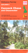
| 244 | Cannock Chase & Chasewater | formerly 6 | ||
| 245 | The National Forest, Burton-upon-Trent | |||
| 246 | Loughborough | |||
| 247 | Grantham | |||
| 248 | Borne & Heckington | |||
| 249 | Spalding & Holbeach | |||
| 250 | Norfolk Coast West | |||
| 251 | Norfolk Coast Central | |||
| 252 | Norfolk Coast East | |||
| 253 | Lleyn Peninsula West | Pen Llyn Ardal Orllewinol | ||
| 254 | Lleyn Peninsula East | Pen Lyn Ardal Ddwyreriniol | ||
| 255 | Llangollen & Berwyn | |||
| 256 | Wrexham & Llangollen | Wrecsam a Llangollen | ||
| 257 | Crewe & Nantwich | |||
| 258 | Stoke-on-Trent & Newcastle-under-Lyne | |||
| 259 | Derby | |||
| 260 | Nottingham | |||
| 261 | Boston | |||
| 262 | Angelsey West | Gorllewin Ynys Mon | ||
| 263 | Anglesey East | Dwyrain Ynys Mon | ||
| 264 | Vale of Clwyd | Dyffryn Clwyd | ||
| 265 | Clwydian Range | Bryniau Clwyd | ||
| 266 | Wirral & Chester | |||
| 267 | Northwich & Delamere Forest | |||
| 268 | Wilmslow, Macclesfield & Congleton | |||
| 269 | Chesterfield & Alfreton | |||
| 270 | Sherwood Forest | |||
| 271 | Newark-on-Trent | |||
| 272 | Lincoln | |||
| 273 | Lincolnshire Wolds South | |||
| 274 | Skegness, Alford & Spilsby | |||
| 275 | Liverpool | |||
| 276 | Bolton, Wigan & Warrington | |||
| 277 | Manchester & Salford | |||
| 278 | Sheffield & Barnsley | |||
| 279 | Doncaster | |||
| 280 | Isle of Axholme | |||
| 281 | Ancholme Valley | |||
| 282 | Lincolnshire Wolds North | |||
| 283 | Louth & Mablethorpe | |||
| 284 | Grimsby, Cleethorpes & Immingham | |||
| 285 | Southport & Chorley | |||
| 286 | Blackpool & Preston | |||
| 287 | West Pennine Moors | formerly 19 | ||
| 288 | Bradford & Huddersfield | |||
| 289 | Leeds | |||
| 290 | York | |||
| 291 | Goole & Gilberdyke | |||
| 292 | Withernsea & Spurn Head | |||
| 293 | Kingston upon Hull & Beverley | |||
| 294 | Market Weighton & Yorkshire Wolds Central | |||
| 295 | Bridlington, Driffield & Hornsea | |||
| 296 | Lancaster, Morecambe & Fleetwood | |||
| 297 | Lower Wharfedale & Washburn Valley | |||
| 298 | Nidderdale | |||
| 299 | Ripon & Boroughbridge |
| OS Explorer | ||||||||
| ||||||||
| ||||||||
|


