OS One Inch
| OS One Inch | |||
 | |||
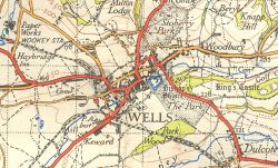 | |||
| Wells in 1946, from sheet 165 | |||
| |||
| Publisher: | Ordnance Survey | ||
| Scale: | 1:63,360 | ||
| First Published: | 1801 | ||
| Final Publication: | 1974 | ||
| SABRE Maps layer: | Yes | ||
The Ordnance Survey One-Inch series was first published in 1805 (after an initial one-sheet printing in 1801), and was for nearly two centuries the main mapping series of the OS.
The series was replaced as the main mapping series in the mid-1970s by the 1:50000 metric series of maps, now known as the Landranger. One-Inch maps, however, were still produced as late as 2002 within the Tourist Map series.
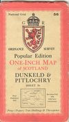
Popular Edition
Main Article: OS Popular Edition
This mapping is available on SABRE Maps
The Ordnance Survey Popular Edition was launched just after World War One, and consisted of two sets of maps. Scotland was covered in 92 sheets, with England and Wales covered in a separate series of 146 sheets. Both series were mainly covered in three-panel maps, although a few areas, notably western Scotland, saw the later style of four-panel maps.
Equally, while most of the maps were aligned with their wider dimension East-West, some were North-South to better cover the country.
Popular Edition maps even after 1922 did not include road numbers upon them, although late printings did indicate "A" class roads on them. As the later Fifth and New Popular series were never published in Scotland, post-war Scottish Popular sheets do have both A and B class roads shown.
Fifth Edition
This mapping is partially available on SABRE Maps
The Fifth Edition was introduced in 1931 on a new projection of the National Yard Grid. They introduced the use of colour rather than contour lines to indicate relief, although later editions reverted to the use of contour lines. They were generally unpopular, and were withdrawn in 1941. The only sheets produced were all in southern England, on a line generally south of the M4.
There were a number of Tourist and District sheets associated with the Fifth Edition, and produced in the Fifth Edition style. One of these, the Two Inch map of the Scilly Isles, was the final Fifth Edition mapping produced and lasted well into the post-war period, with the final edition being produced as late as 1959.
Sixth Series
This mapping is available on SABRE Maps
After the Second World War, the Ordnance Survey started to launch a new range of One-Inch maps, to replace the Popular Edition this time covering the whole of Great Britain. Instead of a confused selection of different series, everywhere from the Shetlands to the Scillys would be covered in a single range of maps at a scale of one inch to the mile.
More commonly known as the New Popular Edition, the Sixth Series was essentially based on pre-war mapping for England and Wales. However, as the sheets progressed northwards fresh mapping was needed for many parts of Scotland to suit the new sheet coverage. Because the New Popular Edition was produced very quickly in order to produce up to date mapping in the immediate postwar period, the Ordnance Survey were generally unsatisfied with the results. Two principal complaints stemmed from the lack of clarity in urban areas, and the difficulty in distinguishing second class and unclassified roads. Consequently, in the late 1940s, the decision was made to produce an entirely new series of mapping, and hence no New Popular maps of Scotland were ever produced.
Covers
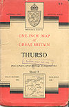
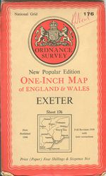
The New Popular Edition covers reflected those of earlier maps, with a prominent coat of arms at the top of the sheet, a red border around all four sides and a small map showing 'area covered'.
Seventh Series
This mapping is available on SABRE Maps
The Seventh Series was introduced in 1952 as an updated style of one-inch mapping. It took nearly 10 years before all sheets were converted to the new style, which retained the former sheet numbers. The differences between 6th and 7th are easy to see, with the newer maps being much clearer and less cluttered in style, with sharper more modern fonts. B roads had also gained their own colour, being shown in brown with minor roads in yellow as opposed to them both being depicted in orange before.
Among the changes made during the course of the Seventh Series was the introduction, possibly around 1960, of a symbol for dual carriageways (including motorways, which were shown in the same red as A roads). These were represented by using bold black lines rather than faint ones for the outer edges of a road; the central reservation and the two separate carriageways were not directly represented. This method is still seen today in the representation of motorways on Landranger maps.
The Seventh Series were withdrawn in the mid-1970s, and replaced by the metric 1:50,000 series, nowadays known as the Landranger. Large amounts of Seventh Series mapping is available on SABRE Maps, with annual layers across the life of the series.
Covers
The basic information given on the Seventh Series cover was the same as the New Popular Edition, and the same size, the coat of arms was reduced in size, and the red border replaced with read at top and bottom, with black stepped lines either side of the buff centre panel.
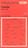
In 1968 the covers were given a radical overhaul, becoming all red with two thirds of the cover showing 'area covered', the remainder reserved for the new OS logo, sheet name, price etc. These maps were simply branded One-inch Map.
In 1970, the price (then 8/-) started being displayed in decimal (40p). After Februrary 1971, the pre-decimal price was blacked out.
London Passenger Transport Map
These maps were published at the One Inch scale in 1934, and are basically overprinted Popular Edition sheets covering the whole London PT area. They are important to us because they show the pre-1935 road numbers at a good scale within the London PT area, which passes well out into the Home Counties.
In many ways, they are reminiscent of the OS Ministry of Transport Road Map series.
Tourist Map
Main Article: OS Tourist
Whilst technically not part of the One Inch family, the Tourist Map series is, at least partially, closely related in that initially it used reframed One Inch mapping to give better coverage where sheets overlapped.
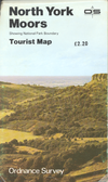
After the replacement of the Seventh Series with the metric 1:50,000 series in 1974, maps at One Inch scale continued to be published by the OS in the Tourist Map series until 2002. In a reversal of fortune, the original 1:50,000 sheets were produced by rescaling Seventh Series sheets, whilst later One Inch Tourist Maps were produced by rescaling Landranger data.
It should be noted that not all Tourist Maps were at a One Inch scale, even before the cancellation of the One Inch series proper.
Sheet List
See main article: One Inch Sheet List
| OS One Inch | ||||||||
| ||||||||
|
