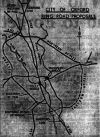
Oxford Ring Road
| Oxford Ring Road | |||||||||||||
| Location Map ( geo) | |||||||||||||
| |||||||||||||
| From: | Oxford | ||||||||||||
| Distance: | 15.6 miles (25.1 km) | ||||||||||||
| Meets: | A34, A40, A44, A420 | ||||||||||||
| Highway Authorities | |||||||||||||
| Traditional Counties | |||||||||||||
| Route outline (key) | |||||||||||||
| |||||||||||||
The Oxford Ring Road is a 15-mile ring road for the town of Oxford, with eight roundabouts and four GSJs. It incorporates part of the A34 Winchester - Oxford trunk road (with a TOTSO for ring road traffic at either end), as well as parts of the A40 and A423 as well as the entire length of the A4142. It also includes a half-mile spur road between the A40/A4144 and A34/A44 junctions, and as the A44 and A4144 both end here either road could claim the spur and therefore be part of the ring road.
For the most part, the road is named 'Northern/Western/Southern Eastern Bypass Road' and is a primary D2.
Route
Section 1: A40 (Peartree - Headington)
See A40 for a more detailed account.
Starting at the Peartree Interchange, the most north-westerly point on the ring road where it meets the A44 and Peartree services, the only service station on the route. Heading clockwise from here, it hops on to A40 which starts off as an urban S2 with parallel roads on either side. This eventually opens up to a rural D2 not too dissimilar to the A34 approaching Botley. At the Headington Roundabout the A40 peels off towards London, with a throughpass for west-to-northbound traffic and more than enough lanes and traffic lights.
Section 2: A4142 (Headington - Littlemore, Heyford Hill)
See also A4142
From the Headington Roundabout the road heads south and crosses a set of lights. Until recently this was the only section of the ring road without a central barrier, but a fatal accident caused a concrete barrier and reduced speed limit to be put in place here. There are two more traffic lights, the second one seeing the start of a short parallel road serving the BMW plant - and signed as such.
Things get impressive now as the road rises to have a grade-separated junction with the B480, shortly before having a roundabout with the A4158. There's a low bridge putting height restrictions on the inside lanes and then the Heyford Hill Roundabout with the A4074 and a Sainsbury's supermarket. The A423 takes over from here.
Section 3: A423 and A34 (Littlemore, Heyford Hill - Peartree)
See A423 and A34 for a more detailed account.
This is a completely isolated section of the A423, but only because the A4074 (which we meet at the starting roundabout) used to be part of it. The A423 then opens out and has a roundabout with the A4144 (Redbridge Park and Ride), and then a short link road to the Hinksey Hill Interchange over the A34.
The ring road heads down the sliproad on to the A34, which heads north on an online upgrade. It cuts through the village of Botley (which was built around it), the only settlement between Winchester and Wendlebury, complete with a 50mph limit and regular congestion. After this it passes beneath the A420 again, and crosses the A40, a railway line and a canal on the Wolvercote Viaduct. Immediately afterwards the ring road heads down the sliproad to the Peartree Interchange.
History
The two oldest sections of the Oxford Ring Road were constructed in the 1930's as single carriageway roads. The first original section opened on 28 June 1932 and was the Southern Bypass, now forming the southbound A34 from A420 at Botley to the Hinksey Hill Interchange at South Hinksey. This section was known locally as the "Road to Nowhere" until the Western Bypass was later tacked onto the northern end of the road. A short section through Botley was converted to dual carriageway as part of the work to construct the Western Bypass in 1961. This was extended through North Hinksey between December 1963 and October 1967. The 2 miles southwards was the last section to be converted to dual carriageway, which occurred between May 1970 and March 1974.
The second original section was the Northern Bypass which opened in July 1934 and now forms the present-day A40 from Wolvercote Roundabout (A34 later renumbered A44) to Headington Roundabout, London Road. This section was converted to dual carriageway after May 1970.
The Eastern Bypass was completed in two sections. Stage 1 was Garsington Road (B480) to Littlemore Roundabout, Oxford Road (the old Henley Road A423, later renumbered A4158). The 1 mile section was opened in July 1958 and was built by Oxfordshire County Council using direct labour. Stage 2 was Headington Roundabout, London Road (A40) to Garsington Road (B480). The 2.5 mile section was opened in late 1959. Oxford City Council used contractors, cost £1 million. Both sections were constructed as dual carriageway.
The Western Bypass from Botley (A420) to Peartree Interchange (A34, later renumbered as A44) was opened on 22 November 1961. It was with the opening of this section that the A34 could eventually be re-routed away from Oxford City Centre. The new road continued onwards to Kidlington (A423, later renumbered as A4260). The 3.5 mile dual carriageway cost £1.5 million. It included the 850 foot long Wolvercote Viaduct with 12 spans crossing the A40, Oxford Canal and a railway line.
The extension of the Southern Bypass from the Hinksey Hill Interchange to Heyford Hill Roundabout was opened in 1965. In 1966 the last section of the Ring Road was opened. The final section is known as the Eastern Bypass Extension and is the section between Littlemore Roundabout, Oxford Road and Heyford Hill Roundabout. Both these sections were built as dual carriageway. There was also a new dual carriageway connection to bypass Sandford-on-Thames.
Links
| Oxford Ring Road | ||||
| ||||
| ||||
| ||||
|


