Star.pngStar.pngStar grey.pngStar grey.pngStar grey.png

R148

From Roader's Digest: The SABRE Wiki
Jump to navigation Jump to search
R148
Location Map ( geo)
Cameraicon.png View gallery (35)
From:  Dublin (O160344)
To:  Heathstown (N529493)
Via:  Maynooth
Distance:  70.7 km (43.9 miles)
Meets:  R105, R138, R108, R803, R804, R805, R109, R111, R839, R833, R112, M50, N4, R403, R419, R404, R449, R157, R406, R408, R407, R125, R158, M4, R402, R159, R160, R401, R446, R161
Former Number(s):  N4, T3
Highway Authorities

Dublin City • Kildare County • Meath County • South Dublin County • Westmeath County

Traditional Counties

Dublin • Kildare • Meath • Westmeath

The gyratory at Islandbridge.

The R148 follows the original, pre-motorway, route of the N4 DublinSligo road from the centre of Dublin as far as junction 13 of the present M4/N4 at McNead's Bridge in the townland of Heathstown between Kinnegad and Mullingar, County Westmeath.

Starting on Aston Quay, at the south-west corner of O'Connell Bridge, it first runs west along the south bank quays of the Liffey, turning left into St John's Road West at the Frank Sherwin Bridge to pass along the southern side of the Heuston station, crossing the railway on John's Bridge.

From here, the route continues westward along the Liffey Valley, although often a little removed from the river itself. St John's Road West was originally the N7, while the Chapelizod Bypass opened in 1987. At the time this opened, the junction near Kilmainham would have been one of the first times traffic would have needed to stop.

From Palmerstown Interchange, the route is now subsumed into the first 6.5 km of the N4, before that road becomes the M4 at junction 5 at the western end of the Lucan Bypass, and the R148 sets off once more, running for some 55 km through Leixlip, Maynooth, Kilcock, and Kinnegad, finally rejoining the N4 where that route's motorway section ends, at the above-mentioned junction 13.


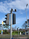
R148
Junctions
Crossings
Roads
Places
Related Pictures
View gallery (35)
Dublin Inner Orbital J24.jpgAerial view N4-M50 Interchange - Coppermine - 20932.jpgFrank Sherwin Bridge from Seán Heuston Bridge.JPGIrish Puffin crossing, South Dublin - Coppermine - 10446.jpgR148 The New Bridge.jpg
Other nearby roads
Dublin
Dublin Inner Orbital Route • Dublin Outer Orbital Route • E01 • E20 • E104 (Dublin - Killeen) • E105 (Dublin - Rosslare) • E107 (Dublin - Cork) • E108 (Dublin - Shannon) • E118 (Old System) • E122 (Old System) • E124 (Old System) • E125 (Old System) • E126 (Old System) • EuroVelo 2 • Fairview Spur • L1 • L6 • M1 (Republic of Ireland) • M11 (Republic of Ireland) • M32 (Republic of Ireland) • M50 (Republic of Ireland) • N1 • N2 • N3 • N4 • N7 • N11 • N31 • N32 • N50 • N81 • R101 • R102 • R103 • R104 • R105 • R106 • R107 • R108 • R109 • R110 • R111 • R112 • R113 • R114 • R115 • R117 • R118 • R121 • R122 • R123 • R124 • R131 • R132 • R133 • R134 • R135 • R137 • R138 • R147 • R801 • R802 • R803 • R804 • R805 • R806 • R807 • R808 • R809 • R810 • R811 • R812 • R813 • R814 • R815 • R816 • R817 • R818 • R819 • R820 • R824 • R825 • R833 • R834 • R839 • R840 • T1 • T2 • T3 • T5 • T7 • T35 • T42 • T43 • T44 • T5A
Kinnegad
M4 (Republic of Ireland) • M6 (Republic of Ireland) • N4 • N6 • R161 • R401 • R446 • T3 • T4 • T26
R100-R199
R100 • R101 • R102 • R103 • R104 • R105 • R106 • R107 • R108 • R109 • R110 • R111 • R112 • R113 • R114 • R115 • R116 • R117 • R118 • R119
R120 • R121 • R122 • R123 • R124 • R125 • R126 • R127 • R128 • R129 • R130 • R131 • R132 • R133 • R134 • R135 • R136 • R137 • R138 • R139
R140 • R141 • R142 • R143 • R144 • R145 • R146 • R147 • R148 • R149 • R150 • R151 • R152 • R153 • R154 • R155 • R156 • R157 • R158 • R159
R160 • R161 • R162 • R163 • R164 • R165 • R166 • R167 • R168 • R169 • R170 • R171 • R172 • R173 • R174 • R175 • R176 • R177 • R178 • R179
R180 • R181 • R182 • R183 • R184 • R185 • R186 • R187 • R188 • R189 • R190 • R191 • R192 • R193 • R194 • R195 • R196 • R197 • R198 • R199

SABRE - The Society for All British and Irish Road Enthusiasts
Discuss - Digest - Discover - Help