Watermead Bridge
Jump to navigation
Jump to search
| Watermead Bridge | |||
| Location Map ( geo) | |||
 | |||
| |||
| To: | Leicester Outer Ring Road | ||
| Location | |||
| Birstall,Leicester | |||
| County | |||
| Leicestershire | |||
| Highway Authority | |||
| Leicester | |||
| Additional Information | |||
| |||
| On road(s) | |||
| A563 | |||
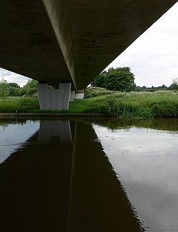
Watermead Bridge is a bridge across the River Soar forming the southern section of the Leicester Outer Ring Road. The road at this point is called Watermead Way (A563)
| Watermead Bridge | ||
| ||
|
